Henderson - Henderson
Flight / Schedule
Henderson - Henderson
Aircraft
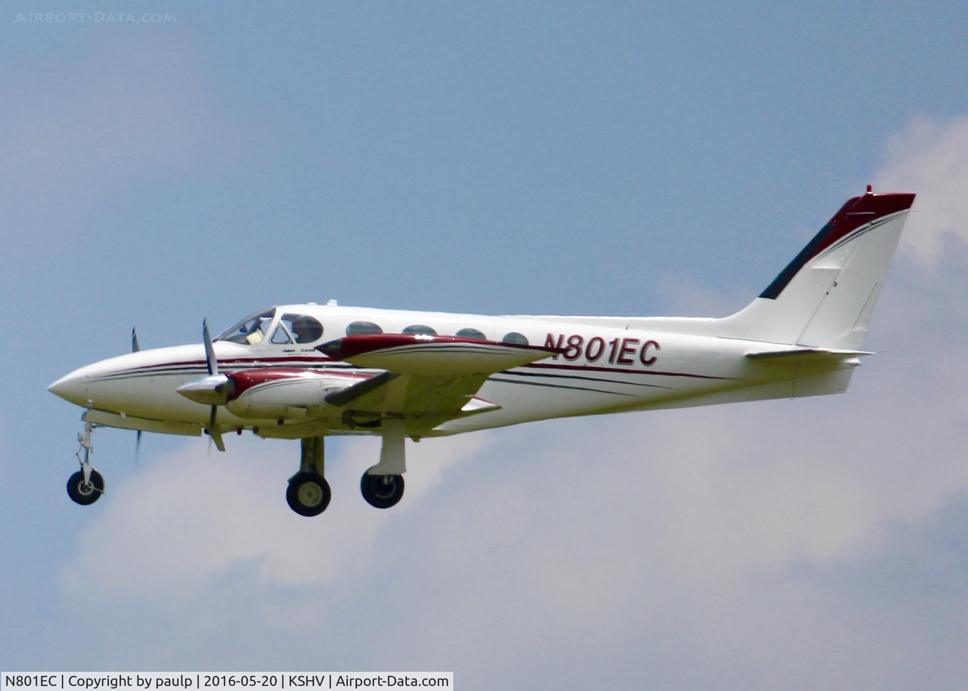
Cessna 340Registration
N801EC
MSN
340A-0312
Year of Manufacture
1977
Operator
William J. WeatherspoonDate
April 19, 2021 at 01:46 PM
Type
CRASHFlight Type
Test
Flight Phase
Flight
Crash Site
Plain, Valley
Crash Location
Tatum Texas
Region
North America • United States of America
Coordinates
32.3151°, -94.5164°
Narrative Report
On April 19, 2021 at 01:46 PM, Henderson - Henderson experienced a crash involving Cessna 340, operated by William J. Weatherspoon, with the event recorded near Tatum Texas.
The flight was categorized as test and the reported phase was flight at a plain, valley crash site.
1 people were known to be on board, 1 fatalities were recorded, 0 survivors were identified or estimated. This corresponds to an estimated fatality rate of 100.0%.
Crew on board: 1, crew fatalities: 1, passengers on board: 0, passenger fatalities: 0, other fatalities: 0.
On April 19, 2021, about 1346 central daylight time, a Cessna 340A airplane, N801EC, was destroyed when it was involved in an accident near Tatum, Texas. The pilot was fatally injured. The airplane was operated as a Title 14 Code of Federal Regulations Part 91 flight test. According to information provided by a Fixed Base Operator (FBO) at the East Texas Regional Airport (GGG), the intention of the flight was to do a functional test of a newly upgraded autopilot system. Automatic Dependent Surveillance – Broadcast (ADS-B) data showed that the airplane took off from runway 13 at GGG about 1340. According to preliminary Air Traffic Control (ATC) information provided by the Federal Aviation Administration (FAA), the controller cleared the pilot to operate under Visual Flight Rules (VFR) to the east of the airport and to remain in class C airspace. Communications between ground control, tower control, and the pilot were normal during the ground taxi, takeoff, and climb-out. Six minutes after takeoff, radio and radar communications were lost and controllers initiated ALNOT procedures. There were no radio distress calls heard from the pilot. After takeoff, ADS-B data showed the airplane in a steady climb to the east of GGG. The airplane climbed to an altitude of 2,750 ft mean sea level (msl) and then descended to 2,675 ft msl. There were no other data points recorded. The accident site was located directly east, about ¾ mile from the last recorded data point. Groundspeeds and headings were consistent throughout the climb, with no abrupt deviations. There were no eyewitnesses to the accident; however, a local resident located about 1 mile from the accident site reported that he was inside his residence when he heard and felt a “boom” that shook the windows. He immediately saw black smoke rise, found the wreckage, and called 911. The accident site was located at an elevation of 361 ft msl. The airplane impacted the vegetated terrain in a nose-down, vertical flight attitude. The fuselage and cabin were embedded into the ground and were mostly consumed from a post-impact fire. The empennage was folded forward over the cabin area. Both left and right wings showed leading edge crushing along their respective spans. Portions of both wings were fire damaged. Both left and right engine nacelles were separated from the wings and the engine and propeller assemblies were embedded in 3-foot-deep craters.
Aircraft reference details include registration N801EC, MSN 340A-0312, year of manufacture 1977.
Geospatial coordinates for this crash are approximately 32.3151°, -94.5164°.
Fatalities
Total
1
Crew
1
Passengers
0
Other
0
Crash Summary
On April 19, 2021, about 1346 central daylight time, a Cessna 340A airplane, N801EC, was destroyed when it was involved in an accident near Tatum, Texas. The pilot was fatally injured. The airplane was operated as a Title 14 Code of Federal Regulations Part 91 flight test. According to information provided by a Fixed Base Operator (FBO) at the East Texas Regional Airport (GGG), the intention of the flight was to do a functional test of a newly upgraded autopilot system. Automatic Dependent Surveillance – Broadcast (ADS-B) data showed that the airplane took off from runway 13 at GGG about 1340. According to preliminary Air Traffic Control (ATC) information provided by the Federal Aviation Administration (FAA), the controller cleared the pilot to operate under Visual Flight Rules (VFR) to the east of the airport and to remain in class C airspace. Communications between ground control, tower control, and the pilot were normal during the ground taxi, takeoff, and climb-out. Six minutes after takeoff, radio and radar communications were lost and controllers initiated ALNOT procedures. There were no radio distress calls heard from the pilot. After takeoff, ADS-B data showed the airplane in a steady climb to the east of GGG. The airplane climbed to an altitude of 2,750 ft mean sea level (msl) and then descended to 2,675 ft msl. There were no other data points recorded. The accident site was located directly east, about ¾ mile from the last recorded data point. Groundspeeds and headings were consistent throughout the climb, with no abrupt deviations. There were no eyewitnesses to the accident; however, a local resident located about 1 mile from the accident site reported that he was inside his residence when he heard and felt a “boom” that shook the windows. He immediately saw black smoke rise, found the wreckage, and called 911. The accident site was located at an elevation of 361 ft msl. The airplane impacted the vegetated terrain in a nose-down, vertical flight attitude. The fuselage and cabin were embedded into the ground and were mostly consumed from a post-impact fire. The empennage was folded forward over the cabin area. Both left and right wings showed leading edge crushing along their respective spans. Portions of both wings were fire damaged. Both left and right engine nacelles were separated from the wings and the engine and propeller assemblies were embedded in 3-foot-deep craters.
Occupants & Outcome
Crew On Board
1
Passengers On Board
0
Estimated Survivors
0
Fatality Rate
100.0%
Known people on board: 1
Operational Details
Schedule / Flight
Henderson - Henderson
Operator
William J. WeatherspoonFlight Type
Test
Flight Phase
Flight
Crash Site
Plain, Valley
Region / Country
North America • United States of America
Aircraft Details
Similar Plane Crashes
United States Signal Corps - USSC
De Havilland DH.4
The single engine airplane departed Dayton-McCook Field for a local test flight. Shortly after takeoff, the aircraft stalled and crashed, killing both occupants. Crew: Maj Oscar Brindley, Lt Col Henry Damm.
United States Signal Corps - USSC
De Havilland DH.4
Lt. Frank Stuart Patterson, son and nephew of the co-founders of National Cash Register, is killed in the crash of his DH.4M, AS-32098, at Wilbur Wright Field during a flight test of a new mechanism for synchronizing machine gun and propeller, when a tie rod breaks during a dive from 15,000 feet (4,600 m), causing the wings to separate from the aircraft. Wishing to recognize the contributions of the Patterson family (owners of NCR) the area of Wright Field east of Huffman Dam (including Wilbur Wright Field, Fairfield Air Depot, and the Huffman Prairie) is renamed Patterson Field on 6 July 1931, in honor of Lt. Patterson.
United States Signal Corps - USSC
De Havilland DH.4
The aircraft crashed in unknown circumstances.
United States Signal Corps - USSC
De Havilland DH.4
The crew was completing a training mission. At an altitude of about 4,000 feet, the aircraft entered a spin and crashed in an open field near Everman-Barron Field Airport. A crew was killed and the second occupants was injured. The aircraft was destroyed.
U.S. Air Mail Service
De Havilland DH.4
Crashed following an engine failure. Pilot fate unknown.
United States Signal Corps - USSC
De Havilland DH.4
The accident occurred in unknown circumstances.