Peachtree City - Nashville
Flight / Schedule
Peachtree City - Nashville
Aircraft
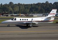
Cessna 501 Citation IRegistration
N501RG
MSN
501-0260
Year of Manufacture
1982
Operator
Remonia AirDate
February 8, 2020 at 10:11 AM
Type
CRASHFlight Type
Private
Flight Phase
Flight
Crash Site
Plain, Valley
Crash Location
Fairmount Georgia
Region
North America • United States of America
Coordinates
34.4362°, -84.6999°
Narrative Report
On February 8, 2020 at 10:11 AM, Peachtree City - Nashville experienced a crash involving Cessna 501 Citation I, operated by Remonia Air, with the event recorded near Fairmount Georgia.
The flight was categorized as private and the reported phase was flight at a plain, valley crash site.
4 people were known to be on board, 4 fatalities were recorded, 0 survivors were identified or estimated. This corresponds to an estimated fatality rate of 100.0%.
Crew on board: 1, crew fatalities: 1, passengers on board: 3, passenger fatalities: 3, other fatalities: 0.
On February 8, 2020, at 1013 eastern standard time, a Cessna 501, N501RG, was substantially damaged after an inflight breakup near Fairmount, Georgia. The private pilot, commercial pilot, and two passengers were fatally injured. The airplane was owned and operated by Remonia Air, LLC. Instrument meteorological conditions prevailed, and an instrument flight rules flight plan was filed for the flight that originated at Falcon Field (FFC), Atlanta, Georgia around 0945. The personal flight was conducted under the provisions of Title 14 Code of Federal Regulations Part 91 and had an intended destination of John C. Tune Airport (JWN), Nashville, Tennessee. According to a fuel receipt, the airplane was "topped off" with 104 gallons of Jet A fuel that was premixed with Prist prior to departing on the accident flight. According to flight plan information that was filed with a commercial vendor, the accident flight was scheduled to depart at 0930 from FFC and arrive at JWN around 1022. Then, another flight plan was filed from JWN back to FFC departing at 1030 and arriving at JWN around 1119. In addition, the flight plan noted in the remarks section that the flight was a "training flight." A preliminary review of air traffic control communications and radar data revealed that a controller issued local weather information and instructed the pilots to climb to 7,000 ft mean sea level (msl). The controller issued the pilots a pilot report (PIREP) for trace to light rime icing between 9,000 ft and 11,000 ft, and one of the pilots acknowledged. Then, the controller instructed the pilots to climb to 10,000 ft and to turn right to 020°. The controller observed the airplane on a northwest bound heading and asked the pilots to verify their heading. A pilot responded that they were returning to a 320° heading, to which the controller instructed him to maintain 10,000 ft. The controller asked the pilots if everything was alright, and a pilot responded that they had a problem with the autopilot. The controller instructed the pilots to again maintain 10,000 ft and to advise when they were able to accept a turn. The controller again asked if everything was alright or if they needed assistance; however, neither pilot responded. The controller again asked the pilots if everything was under control and if they required assistance, to which one of the pilots replied that they were "OK now." The airplane climbed to 10,500 ft and the controller instructed the pilots to maintain 10,000 ft and again asked if everything was under control. A pilot responded in the affirmative and stated that they were "playing with the autopilot" because they were having trouble with it, and the controller suggested that they turn off the autopilot and hand-fly the airplane. The airplane descended to 9,000 ft and the controller instructed the pilots to maintain 10,000 ft and asked them if they could return to the departure airport to resolve the issues. One of the pilots requested a higher altitude to get into visual flight rules (VFR) conditions, and the controller instructed him to climb to 12,000 ft, advised that other aircraft reported still being in the clouds at 17,000 ft, and asked their intentions. The pilot requested to continue to their destination and the controller instructed him to climb to 13,000 ft. One of the pilots established communication with another controller at 11,500 ft and stated they were climbing to 13,000 ft on a 360° heading. The controller instructed the pilot to climb to 16,000 ft and inquired if their navigation issues were corrected. A pilot advised the controller that they had problems with the left side attitude indicator and that they were working off the right side. The controller cleared the airplane direct to the JWN and asked if they were above the clouds as they were climbing through 15,400 ft. The airplane then began a left turn and soon after radar contact was lost at 1013. The controller attempted numerous times to contact the airplane with no response.
Aircraft reference details include registration N501RG, MSN 501-0260, year of manufacture 1982.
Geospatial coordinates for this crash are approximately 34.4362°, -84.6999°.
Fatalities
Total
4
Crew
1
Passengers
3
Other
0
Crash Summary
On February 8, 2020, at 1013 eastern standard time, a Cessna 501, N501RG, was substantially damaged after an inflight breakup near Fairmount, Georgia. The private pilot, commercial pilot, and two passengers were fatally injured. The airplane was owned and operated by Remonia Air, LLC. Instrument meteorological conditions prevailed, and an instrument flight rules flight plan was filed for the flight that originated at Falcon Field (FFC), Atlanta, Georgia around 0945. The personal flight was conducted under the provisions of Title 14 Code of Federal Regulations Part 91 and had an intended destination of John C. Tune Airport (JWN), Nashville, Tennessee. According to a fuel receipt, the airplane was "topped off" with 104 gallons of Jet A fuel that was premixed with Prist prior to departing on the accident flight. According to flight plan information that was filed with a commercial vendor, the accident flight was scheduled to depart at 0930 from FFC and arrive at JWN around 1022. Then, another flight plan was filed from JWN back to FFC departing at 1030 and arriving at JWN around 1119. In addition, the flight plan noted in the remarks section that the flight was a "training flight." A preliminary review of air traffic control communications and radar data revealed that a controller issued local weather information and instructed the pilots to climb to 7,000 ft mean sea level (msl). The controller issued the pilots a pilot report (PIREP) for trace to light rime icing between 9,000 ft and 11,000 ft, and one of the pilots acknowledged. Then, the controller instructed the pilots to climb to 10,000 ft and to turn right to 020°. The controller observed the airplane on a northwest bound heading and asked the pilots to verify their heading. A pilot responded that they were returning to a 320° heading, to which the controller instructed him to maintain 10,000 ft. The controller asked the pilots if everything was alright, and a pilot responded that they had a problem with the autopilot. The controller instructed the pilots to again maintain 10,000 ft and to advise when they were able to accept a turn. The controller again asked if everything was alright or if they needed assistance; however, neither pilot responded. The controller again asked the pilots if everything was under control and if they required assistance, to which one of the pilots replied that they were "OK now." The airplane climbed to 10,500 ft and the controller instructed the pilots to maintain 10,000 ft and again asked if everything was under control. A pilot responded in the affirmative and stated that they were "playing with the autopilot" because they were having trouble with it, and the controller suggested that they turn off the autopilot and hand-fly the airplane. The airplane descended to 9,000 ft and the controller instructed the pilots to maintain 10,000 ft and asked them if they could return to the departure airport to resolve the issues. One of the pilots requested a higher altitude to get into visual flight rules (VFR) conditions, and the controller instructed him to climb to 12,000 ft, advised that other aircraft reported still being in the clouds at 17,000 ft, and asked their intentions. The pilot requested to continue to their destination and the controller instructed him to climb to 13,000 ft. One of the pilots established communication with another controller at 11,500 ft and stated they were climbing to 13,000 ft on a 360° heading. The controller instructed the pilot to climb to 16,000 ft and inquired if their navigation issues were corrected. A pilot advised the controller that they had problems with the left side attitude indicator and that they were working off the right side. The controller cleared the airplane direct to the JWN and asked if they were above the clouds as they were climbing through 15,400 ft. The airplane then began a left turn and soon after radar contact was lost at 1013. The controller attempted numerous times to contact the airplane with no response.
Occupants & Outcome
Crew On Board
1
Passengers On Board
3
Estimated Survivors
0
Fatality Rate
100.0%
Known people on board: 4
Operational Details
Schedule / Flight
Peachtree City - Nashville
Operator
Remonia AirFlight Type
Private
Flight Phase
Flight
Crash Site
Plain, Valley
Region / Country
North America • United States of America
Aircraft Details
Similar Plane Crashes
United States Signal Corps - USSC
De Havilland DH.4
The single engine airplane departed Dayton-McCook Field for a local test flight. Shortly after takeoff, the aircraft stalled and crashed, killing both occupants. Crew: Maj Oscar Brindley, Lt Col Henry Damm.
United States Signal Corps - USSC
De Havilland DH.4
Lt. Frank Stuart Patterson, son and nephew of the co-founders of National Cash Register, is killed in the crash of his DH.4M, AS-32098, at Wilbur Wright Field during a flight test of a new mechanism for synchronizing machine gun and propeller, when a tie rod breaks during a dive from 15,000 feet (4,600 m), causing the wings to separate from the aircraft. Wishing to recognize the contributions of the Patterson family (owners of NCR) the area of Wright Field east of Huffman Dam (including Wilbur Wright Field, Fairfield Air Depot, and the Huffman Prairie) is renamed Patterson Field on 6 July 1931, in honor of Lt. Patterson.
United States Signal Corps - USSC
De Havilland DH.4
The aircraft crashed in unknown circumstances.
United States Signal Corps - USSC
De Havilland DH.4
The crew was completing a training mission. At an altitude of about 4,000 feet, the aircraft entered a spin and crashed in an open field near Everman-Barron Field Airport. A crew was killed and the second occupants was injured. The aircraft was destroyed.
U.S. Air Mail Service
De Havilland DH.4
Crashed following an engine failure. Pilot fate unknown.
United States Signal Corps - USSC
De Havilland DH.4
The accident occurred in unknown circumstances.