Chicago - Columbus
Flight / Schedule
Chicago - Columbus
Aircraft
Rockwell Aero Commander 500Registration
N30MB
MSN
500-1453-160
Year of Manufacture
1964
Operator
Central Air SouthwestDate
November 18, 2014 at 02:45 AM
Type
CRASHFlight Type
Cargo
Flight Phase
Landing (descent or approach)
Crash Site
City
Crash Location
Chicago-Midway Illinois
Region
North America • United States of America
Coordinates
41.7870°, -87.5891°
Crash Cause
Human factor
Narrative Report
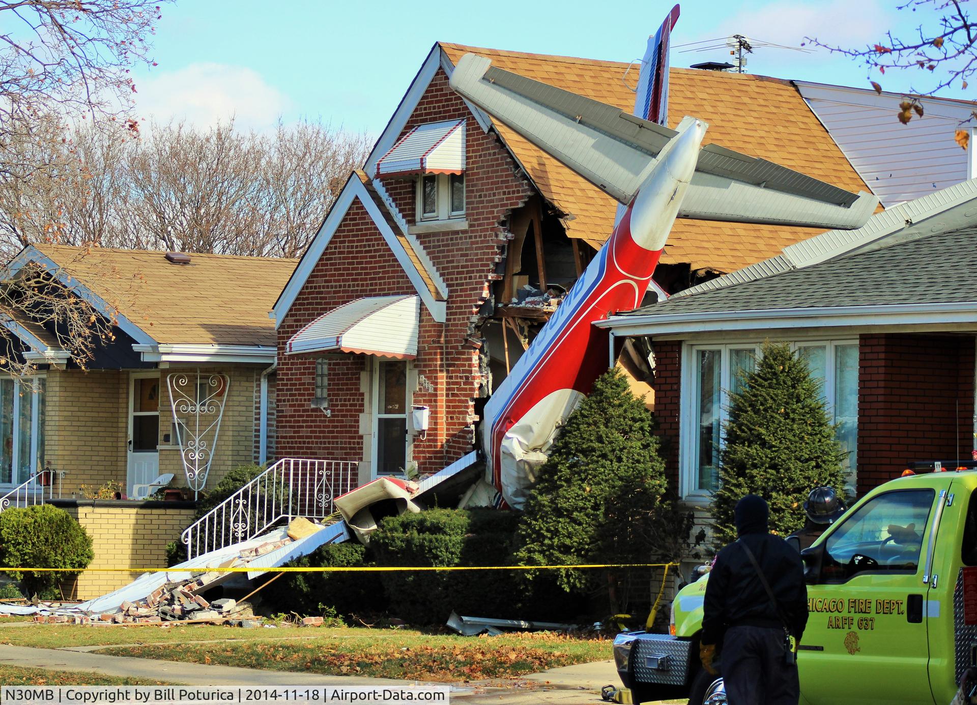
On November 18, 2014 at 02:45 AM, Chicago - Columbus experienced a crash involving Rockwell Aero Commander 500, operated by Central Air Southwest, with the event recorded near Chicago-Midway Illinois.
The flight was categorized as cargo and the reported phase was landing (descent or approach) at a city crash site.
1 people were known to be on board, 1 fatalities were recorded, 0 survivors were identified or estimated. This corresponds to an estimated fatality rate of 100.0%.
Crew on board: 1, crew fatalities: 1, passengers on board: 0, passenger fatalities: 0, other fatalities: 0.
The listed crash cause is human factor. The commercial pilot was conducting an on-demand cargo charter flight. Shortly after takeoff, the pilot informed the tower controller that he wanted to "come back and land" because he was "having trouble with the left engine." The pilot chose to fly a left traffic pattern and return for landing. No further transmissions were received from the pilot. The accident site was located about 0.50 mile southeast of the runway's displaced threshold. GPS data revealed that, after takeoff, the airplane entered a left turn to a southeasterly course and reached a maximum GPS altitude of 959 ft (about 342 ft above ground level [agl]). The airplane then entered another left turn that appeared to continue until the final data point. The altitude associated with the final data point was 890 ft (about 273 ft agl). The final GPS data point was located about 135 ft northeast of the accident site. Based on GPS data and the prevailing surface winds, the airspeed was about 45 knots during the turn. According to the airplane flight manual, the stall speed in level flight with the wing flaps extended was 59 knots. Postaccident examination and testing of the airframe, engines, and related components did not reveal any preimpact mechanical failures or malfunctions that would have precluded normal operation; therefore, the nature of any issue related to the left engine could not be determined. Based on the evidence, the pilot failed to maintain adequate airspeed while turning the airplane back toward the airport, which resulted in an aerodynamic stall/spin.
Aircraft reference details include registration N30MB, MSN 500-1453-160, year of manufacture 1964.
Geospatial coordinates for this crash are approximately 41.7870°, -87.5891°.
Fatalities
Total
1
Crew
1
Passengers
0
Other
0
Crash Summary
The commercial pilot was conducting an on-demand cargo charter flight. Shortly after takeoff, the pilot informed the tower controller that he wanted to "come back and land" because he was "having trouble with the left engine." The pilot chose to fly a left traffic pattern and return for landing. No further transmissions were received from the pilot. The accident site was located about 0.50 mile southeast of the runway's displaced threshold. GPS data revealed that, after takeoff, the airplane entered a left turn to a southeasterly course and reached a maximum GPS altitude of 959 ft (about 342 ft above ground level [agl]). The airplane then entered another left turn that appeared to continue until the final data point. The altitude associated with the final data point was 890 ft (about 273 ft agl). The final GPS data point was located about 135 ft northeast of the accident site. Based on GPS data and the prevailing surface winds, the airspeed was about 45 knots during the turn. According to the airplane flight manual, the stall speed in level flight with the wing flaps extended was 59 knots. Postaccident examination and testing of the airframe, engines, and related components did not reveal any preimpact mechanical failures or malfunctions that would have precluded normal operation; therefore, the nature of any issue related to the left engine could not be determined. Based on the evidence, the pilot failed to maintain adequate airspeed while turning the airplane back toward the airport, which resulted in an aerodynamic stall/spin.
Cause: Human factor
Occupants & Outcome
Crew On Board
1
Passengers On Board
0
Estimated Survivors
0
Fatality Rate
100.0%
Known people on board: 1
Operational Details
Schedule / Flight
Chicago - Columbus
Operator
Central Air SouthwestFlight Type
Cargo
Flight Phase
Landing (descent or approach)
Crash Site
City
Region / Country
North America • United States of America
Aircraft Details
Similar Plane Crashes
United States Signal Corps - USSC
De Havilland DH.4
The single engine airplane departed Dayton-McCook Field for a local test flight. Shortly after takeoff, the aircraft stalled and crashed, killing both occupants. Crew: Maj Oscar Brindley, Lt Col Henry Damm.
United States Signal Corps - USSC
De Havilland DH.4
Lt. Frank Stuart Patterson, son and nephew of the co-founders of National Cash Register, is killed in the crash of his DH.4M, AS-32098, at Wilbur Wright Field during a flight test of a new mechanism for synchronizing machine gun and propeller, when a tie rod breaks during a dive from 15,000 feet (4,600 m), causing the wings to separate from the aircraft. Wishing to recognize the contributions of the Patterson family (owners of NCR) the area of Wright Field east of Huffman Dam (including Wilbur Wright Field, Fairfield Air Depot, and the Huffman Prairie) is renamed Patterson Field on 6 July 1931, in honor of Lt. Patterson.
United States Signal Corps - USSC
De Havilland DH.4
The aircraft crashed in unknown circumstances.
United States Signal Corps - USSC
De Havilland DH.4
The crew was completing a training mission. At an altitude of about 4,000 feet, the aircraft entered a spin and crashed in an open field near Everman-Barron Field Airport. A crew was killed and the second occupants was injured. The aircraft was destroyed.
U.S. Air Mail Service
De Havilland DH.4
Crashed following an engine failure. Pilot fate unknown.
United States Signal Corps - USSC
De Havilland DH.4
The accident occurred in unknown circumstances.