Yellowknife - Resolute Bay - Grise Fiord
Flight / Schedule
Yellowknife - Resolute Bay - Grise Fiord
Aircraft
Boeing 737-200Registration
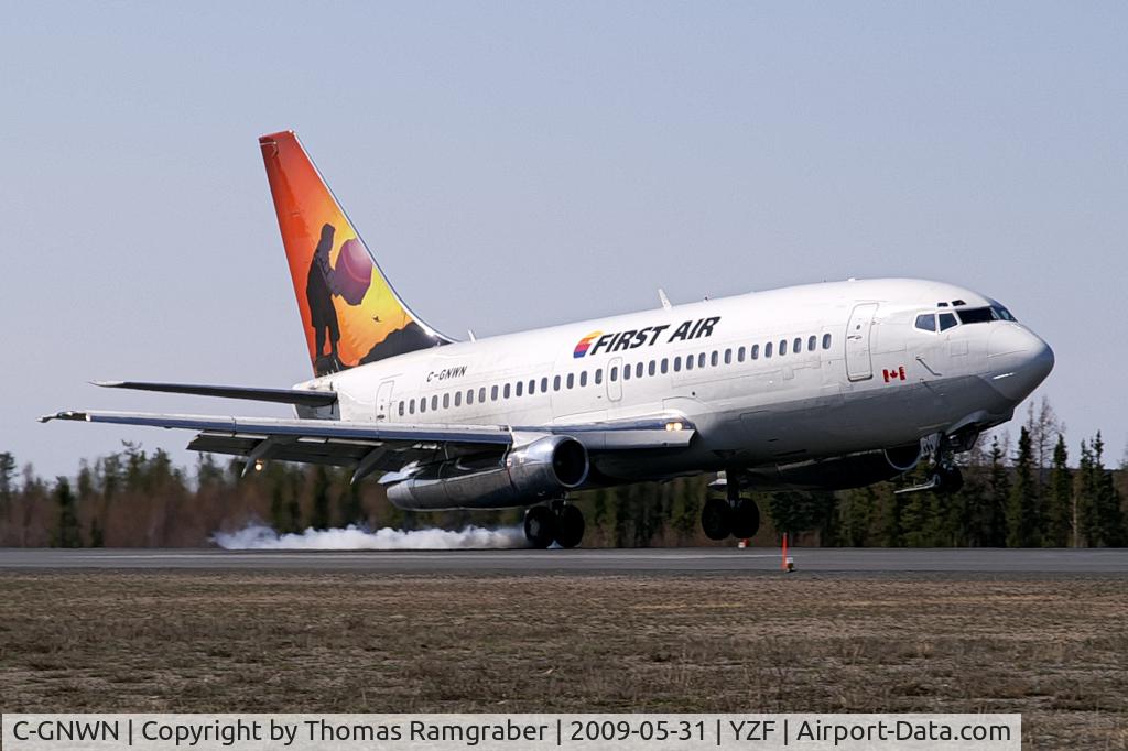
C-GNWN
MSN
21067/414
Year of Manufacture
1975
Operator
First AirDate
August 20, 2011 at 11:42 AM
Type
CRASHFlight Type
Scheduled Revenue Flight
Flight Phase
Landing (descent or approach)
Crash Site
Airport (less than 10 km from airport)
Crash Location
Resolute Bay Nunavut
Region
North America • Canada
Coordinates
74.6791°, -94.8423°
Crash Cause
Human factor
Narrative Report
On August 20, 2011 at 11:42 AM, Yellowknife - Resolute Bay - Grise Fiord experienced a crash involving Boeing 737-200, operated by First Air, with the event recorded near Resolute Bay Nunavut.
The flight was categorized as scheduled revenue flight and the reported phase was landing (descent or approach) at a airport (less than 10 km from airport) crash site.
15 people were known to be on board, 12 fatalities were recorded, 3 survivors were identified or estimated. This corresponds to an estimated fatality rate of 80.0%.
Crew on board: 4, crew fatalities: 4, passengers on board: 11, passenger fatalities: 8, other fatalities: 0.
The listed crash cause is human factor. The First Air Boeing 737-210C combi aircraft departed Yellowknife (CYZF), Northwest Territories, at 1440 as First Air flight 6560 (FAB6560) on a charter flight to Resolute Bay (CYRB), Nunavut, with 11 passengers, 4 crew members, and freight on board. The instrument flight rules (IFR) flight from CYZF was flight-planned to take 2 hours and 05 minutes at 426 knots true airspeed and a cruise altitude of flight level (FL) 310. Air traffic control (ATC) cleared FAB6560 to destination via the flight-planned route: CYZF direct to the BOTER intersection, then direct to the Cambridge Bay (CB) non-directional beacon (NDB), then direct to 72° N, 100°45' W, and then direct to CYRB (Figure 1). The planned alternate airport was Hall Beach (CYUX), Nunavut. The estimated time of arrival (ETA) at CYRB was 1645. The captain occupied the left seat and was designated as the pilot flying (PF). The first officer (FO) occupied the right seat and was designated as the pilot not flying (PNF). Before departure, First Air dispatch provided the crew with an operational flight plan (OFP) that included forecast and observed weather information for CYZF, CYRB, and CYUX, as well as NOTAM (notice to airmen) information. Radar data show that FAB6560 entered the Northern Domestic Airspace (NDA) 50 nautical miles (nm) northeast of CYZF, approximately at RIBUN waypoint (63°11.4' N, 113°32.9' W) at 1450. During the climb and after leveling at FL310, the crew received CYRB weather updates from a company dispatcher (Appendix A). The crew and dispatcher discussed deteriorating weather conditions at CYRB and whether the flight should return to CYZF, proceed to the alternate CYUX, or continue to CYRB. The crew and dispatcher jointly agreed that the flight would continue to CYRB. At 1616, the crew programmed the global positioning systems (GPS) to proceed from their current en-route position direct to the MUSAT intermediate waypoint on the RNAV (GNSS) Runway (RWY) 35 TRUE approach at CYRB (Appendix B), which had previously been loaded into the GPS units by the crew. The crew were planning to transition to an ILS/DME RWY 35 TRUE approach (Appendix C) via the MUSAT waypoint. A temporary military terminal control area (MTCA) had been planned, in order to support an increase in air traffic at CYRB resulting from a military exercise, Operation NANOOK. A military terminal control unit at CYRB was to handle airspace from 700 feet above ground level (agl) up to FL200 within 80 nm of CYRB. Commencing at 1622:16, the FO made 3 transmissions before establishing contact with the NAV CANADA Edmonton Area Control Centre (ACC) controller. At 1623:29, the NAV CANADA Edmonton ACC controller cleared FAB6560 to descend out of controlled airspace and to advise when leaving FL270. The crew were also advised to anticipate calling the CYRB terminal control unit after leaving FL270, and that there would be a layer of uncontrolled airspace between FL270 and FL200. The FO acknowledged the information. FAB6560 commenced descent from FL310 at 1623:40 at 101 nm from CYRB. The crew initiated the pre-descent checklist at 1624 and completed it at 1625. At 1626, the crew advised the NAV CANADA Edmonton ACC controller that they were leaving FL260. At 1627:09, the FO subsequently called the CYRB terminal controller and provided an ETA of 1643 and communicated intentions to conduct a Runway 35 approach. Radio readability between FAB6560 and the CYRB terminal controller was poor, and the CYRB terminal controller advised the crew to try again when a few miles closer. At 1629, the crew contacted the First Air agent at CYRB on the company frequency. The crew advised the agent of their estimated arrival time and fuel request. The crew then contacted the CYRB terminal controller again, and were advised that communications were now better. The CYRB terminal controller advised that the MTCA was not yet operational, and provided the altimeter setting and traffic information for another inbound flight. The CYRB terminal controller then instructed the crew to contact the CYRB tower controller at their discretion. The FO acknowledged the traffic and the instruction to contact CYRB tower. At 1631, the crew contacted the CYRB tower controller, who advised them of the altimeter setting (29.81 inches of mercury [in. Hg]) and winds (estimated 160° true [T] at 10 knots), and instructed them to report 10 nm final for Runway 35T. The crew asked the tower controller for a runway condition report, and was advised that the runway was a little wet and that no aircraft had used it during the morning. The FO acknowledged this information. The crew initiated the in-range checklist at 1632 and completed it at 1637. At 1637, they began configuring the aircraft for approach and landing, and initiated the landing checklist. At 1638:21, FAB6560 commenced a left turn just before reaching MUSAT waypoint. At the time of the turn, the aircraft was about 600 feet above the ILS glideslope at 184 knots indicated airspeed (KIAS). The track from MUSAT waypoint to the threshold of Runway 35T is 347°T, which coincides with the localizer track for the ILS/DME RWY 35 TRUE approach. After rolling out of the left turn, FAB6560 proceeded on a track of approximately 350°T. At 1638:32, the crew reported 10 nm final for Runway 35T. The captain called for the gear to be lowered at 1638:38 and for flaps 15 at 1638:42. Airspeed at the time of both of these calls was 177 KIAS. At 1638:39, the CYRB tower controller acknowledged the crew’s report and instructed them to report 3 nm final. At 1638:46, the FO requested that the tower repeat the last transmission. At 1638:49, the tower repeated the request to call 3 nm final; the FO acknowledged the call. At this point in the approach, the crew had a lengthy discussion about aircraft navigation. At 1640:36, FAB6560 descended through 1000 feet above field elevation. Between 1640:41 and 1641:11, the captain issued instructions to complete the configuration for landing, and the FO made several statements regarding aircraft navigation and corrective action. At 1641:30, the crew reported 3 nm final for Runway 35T. The CYRB tower controller advised that the wind was now estimated to be 150°T at 7 knots, cleared FAB6560 to land Runway 35T, and added the term “check gear down” as required by the NAV CANADA Air Traffic Control Manual of Operations (ATC MANOPS) Canadian Forces Supplement (CF ATC Sup) Article 344.3. FAB6560’s response to the tower (1641:39) was cut off, and the tower requested the crew to say again. There was no further communication with the flight. The tower controller did not have visual contact with FAB6560 at any time. At 1641:51.8, as the crew were initiating a go-around, FAB6560 collided with terrain about 1 nm east of the midpoint of the CYRB runway. The accident occurred during daylight hours and was located at 74°42'57.3" N, 94°55'4.0" W, at 396 feet above mean sea level. The 4 crew members and 8 passengers were fatally injured. Three passengers survived the accident and were rescued from the site by Canadian military personnel, who were in CYRB participating in Operation NANOOK. The survivors were subsequently evacuated from CYRB on a Canadian Forces CC-177 aircraft.
Aircraft reference details include registration C-GNWN, MSN 21067/414, year of manufacture 1975.
Geospatial coordinates for this crash are approximately 74.6791°, -94.8423°.
Fatalities
Total
12
Crew
4
Passengers
8
Other
0
Crash Summary
The First Air Boeing 737-210C combi aircraft departed Yellowknife (CYZF), Northwest Territories, at 1440 as First Air flight 6560 (FAB6560) on a charter flight to Resolute Bay (CYRB), Nunavut, with 11 passengers, 4 crew members, and freight on board. The instrument flight rules (IFR) flight from CYZF was flight-planned to take 2 hours and 05 minutes at 426 knots true airspeed and a cruise altitude of flight level (FL) 310. Air traffic control (ATC) cleared FAB6560 to destination via the flight-planned route: CYZF direct to the BOTER intersection, then direct to the Cambridge Bay (CB) non-directional beacon (NDB), then direct to 72° N, 100°45' W, and then direct to CYRB (Figure 1). The planned alternate airport was Hall Beach (CYUX), Nunavut. The estimated time of arrival (ETA) at CYRB was 1645. The captain occupied the left seat and was designated as the pilot flying (PF). The first officer (FO) occupied the right seat and was designated as the pilot not flying (PNF). Before departure, First Air dispatch provided the crew with an operational flight plan (OFP) that included forecast and observed weather information for CYZF, CYRB, and CYUX, as well as NOTAM (notice to airmen) information. Radar data show that FAB6560 entered the Northern Domestic Airspace (NDA) 50 nautical miles (nm) northeast of CYZF, approximately at RIBUN waypoint (63°11.4' N, 113°32.9' W) at 1450. During the climb and after leveling at FL310, the crew received CYRB weather updates from a company dispatcher (Appendix A). The crew and dispatcher discussed deteriorating weather conditions at CYRB and whether the flight should return to CYZF, proceed to the alternate CYUX, or continue to CYRB. The crew and dispatcher jointly agreed that the flight would continue to CYRB. At 1616, the crew programmed the global positioning systems (GPS) to proceed from their current en-route position direct to the MUSAT intermediate waypoint on the RNAV (GNSS) Runway (RWY) 35 TRUE approach at CYRB (Appendix B), which had previously been loaded into the GPS units by the crew. The crew were planning to transition to an ILS/DME RWY 35 TRUE approach (Appendix C) via the MUSAT waypoint. A temporary military terminal control area (MTCA) had been planned, in order to support an increase in air traffic at CYRB resulting from a military exercise, Operation NANOOK. A military terminal control unit at CYRB was to handle airspace from 700 feet above ground level (agl) up to FL200 within 80 nm of CYRB. Commencing at 1622:16, the FO made 3 transmissions before establishing contact with the NAV CANADA Edmonton Area Control Centre (ACC) controller. At 1623:29, the NAV CANADA Edmonton ACC controller cleared FAB6560 to descend out of controlled airspace and to advise when leaving FL270. The crew were also advised to anticipate calling the CYRB terminal control unit after leaving FL270, and that there would be a layer of uncontrolled airspace between FL270 and FL200. The FO acknowledged the information. FAB6560 commenced descent from FL310 at 1623:40 at 101 nm from CYRB. The crew initiated the pre-descent checklist at 1624 and completed it at 1625. At 1626, the crew advised the NAV CANADA Edmonton ACC controller that they were leaving FL260. At 1627:09, the FO subsequently called the CYRB terminal controller and provided an ETA of 1643 and communicated intentions to conduct a Runway 35 approach. Radio readability between FAB6560 and the CYRB terminal controller was poor, and the CYRB terminal controller advised the crew to try again when a few miles closer. At 1629, the crew contacted the First Air agent at CYRB on the company frequency. The crew advised the agent of their estimated arrival time and fuel request. The crew then contacted the CYRB terminal controller again, and were advised that communications were now better. The CYRB terminal controller advised that the MTCA was not yet operational, and provided the altimeter setting and traffic information for another inbound flight. The CYRB terminal controller then instructed the crew to contact the CYRB tower controller at their discretion. The FO acknowledged the traffic and the instruction to contact CYRB tower. At 1631, the crew contacted the CYRB tower controller, who advised them of the altimeter setting (29.81 inches of mercury [in. Hg]) and winds (estimated 160° true [T] at 10 knots), and instructed them to report 10 nm final for Runway 35T. The crew asked the tower controller for a runway condition report, and was advised that the runway was a little wet and that no aircraft had used it during the morning. The FO acknowledged this information. The crew initiated the in-range checklist at 1632 and completed it at 1637. At 1637, they began configuring the aircraft for approach and landing, and initiated the landing checklist. At 1638:21, FAB6560 commenced a left turn just before reaching MUSAT waypoint. At the time of the turn, the aircraft was about 600 feet above the ILS glideslope at 184 knots indicated airspeed (KIAS). The track from MUSAT waypoint to the threshold of Runway 35T is 347°T, which coincides with the localizer track for the ILS/DME RWY 35 TRUE approach. After rolling out of the left turn, FAB6560 proceeded on a track of approximately 350°T. At 1638:32, the crew reported 10 nm final for Runway 35T. The captain called for the gear to be lowered at 1638:38 and for flaps 15 at 1638:42. Airspeed at the time of both of these calls was 177 KIAS. At 1638:39, the CYRB tower controller acknowledged the crew’s report and instructed them to report 3 nm final. At 1638:46, the FO requested that the tower repeat the last transmission. At 1638:49, the tower repeated the request to call 3 nm final; the FO acknowledged the call. At this point in the approach, the crew had a lengthy discussion about aircraft navigation. At 1640:36, FAB6560 descended through 1000 feet above field elevation. Between 1640:41 and 1641:11, the captain issued instructions to complete the configuration for landing, and the FO made several statements regarding aircraft navigation and corrective action. At 1641:30, the crew reported 3 nm final for Runway 35T. The CYRB tower controller advised that the wind was now estimated to be 150°T at 7 knots, cleared FAB6560 to land Runway 35T, and added the term “check gear down” as required by the NAV CANADA Air Traffic Control Manual of Operations (ATC MANOPS) Canadian Forces Supplement (CF ATC Sup) Article 344.3. FAB6560’s response to the tower (1641:39) was cut off, and the tower requested the crew to say again. There was no further communication with the flight. The tower controller did not have visual contact with FAB6560 at any time. At 1641:51.8, as the crew were initiating a go-around, FAB6560 collided with terrain about 1 nm east of the midpoint of the CYRB runway. The accident occurred during daylight hours and was located at 74°42'57.3" N, 94°55'4.0" W, at 396 feet above mean sea level. The 4 crew members and 8 passengers were fatally injured. Three passengers survived the accident and were rescued from the site by Canadian military personnel, who were in CYRB participating in Operation NANOOK. The survivors were subsequently evacuated from CYRB on a Canadian Forces CC-177 aircraft.
Cause: Human factor
Occupants & Outcome
Crew On Board
4
Passengers On Board
11
Estimated Survivors
3
Fatality Rate
80.0%
Known people on board: 15
Operational Details
Schedule / Flight
Yellowknife - Resolute Bay - Grise Fiord
Operator
First AirFlight Type
Scheduled Revenue Flight
Flight Phase
Landing (descent or approach)
Crash Site
Airport (less than 10 km from airport)
Region / Country
North America • Canada
Aircraft Details
Similar Plane Crashes
Royal Canadian Air Force - RCAF
Avro 504
The pilot, sole on board, was completing a local training flight at Camp Borden Airport. The airplane crashed on takeoff. The pilot was rescued.
Royal Canadian Air Force - RCAF
De Havilland DH.9
Crashed in unknown circumstances.
Canadian Aircraft Company
Avro 504
On approach to Fort Frances, the aircraft stalled and crashed. Both occupants were injured.
Bishop-Barker Aeroplanes
Curtiss HS-2L
Hit tree tops and crashed in Brooklin, north of Oshawa, Ontario. Crew fate unknown.
Vancouver Island Aerial Service
Curtiss JN-4
En route from Alert Bay to Prince Rupert, the pilot Lt Harry W. Brown encountered an unexpected situation and was forced to ditch the aircraft off Nalau Island. He survived by paddling a log into the shipping lane and was picked up by a passing Alaskan steamer. The aircraft was lost.
Royal Canadian Air Force - RCAF
De Havilland DH.9
Crashed in unknown circumstances. Crew fate unknown.