Greenville - Leesburg
Flight / Schedule
Greenville - Leesburg
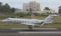
Aircraft
Socata TBM-700Registration
N700PP
MSN
059
Year of Manufacture
1992
Operator
High Performance TechnologiesDate
March 1, 2003 at 02:45 PM
Type
CRASHFlight Type
Executive/Corporate/Business
Flight Phase
Landing (descent or approach)
Crash Site
Airport (less than 10 km from airport)
Crash Location
Leesburg-Executive Virginia
Region
North America • United States of America
Coordinates
39.0768°, -77.5564°
Crash Cause
Human factor
Narrative Report
On March 1, 2003 at 02:45 PM, Greenville - Leesburg experienced a crash involving Socata TBM-700, operated by High Performance Technologies, with the event recorded near Leesburg-Executive Virginia.
The flight was categorized as executive/corporate/business and the reported phase was landing (descent or approach) at a airport (less than 10 km from airport) crash site.
3 people were known to be on board, 3 fatalities were recorded, 0 survivors were identified or estimated. This corresponds to an estimated fatality rate of 100.0%.
Crew on board: 2, crew fatalities: 2, passengers on board: 1, passenger fatalities: 1, other fatalities: 0.
The listed crash cause is human factor. The private pilot, who sat in the left seat, was executing the LOC RWY 17 instrument approach in actual instrument meteorological conditions, when the airplane decelerated, lost altitude, and began a left turn about 2 miles from the airport. Subsequently, the airplane collided with terrain and came to rest on residential property. The radar data also indicated that the airplane was never stabilized on the approach. A witness, a private pilot, said the airplane "appeared" out of the fog about 300-400 feet above the ground. It was in a left bank, with the nose pointed down, and was traveling fast. The airplane then "simultaneously and suddenly level[ed] out," pitched up, and the engine power increased. The witness thought that the pilot realized he was low and was trying to "get out of there." The airplane descended in a nose-high attitude, about 65 degrees, toward the trees. Radar data indicates that the airplane slowed to 80 knots about 3 miles from the airplane, and then to 68 knots 18 seconds later as the airplane began to turn to the left. Examination of the airplane and engine revealed no mechanical deficiencies. Weather reported at the airport 25 minutes before the accident included wind from 140 degrees at 5 knots, visibility 1 statute mile, and ceiling 500 foot overcast. Weather 5 minutes before the accident included wind from 140 degrees at 5 knots, visibility 1 statute miles, and ceiling 300 foot overcast.
Aircraft reference details include registration N700PP, MSN 059, year of manufacture 1992.
Geospatial coordinates for this crash are approximately 39.0768°, -77.5564°.
Fatalities
Total
3
Crew
2
Passengers
1
Other
0
Crash Summary
The private pilot, who sat in the left seat, was executing the LOC RWY 17 instrument approach in actual instrument meteorological conditions, when the airplane decelerated, lost altitude, and began a left turn about 2 miles from the airport. Subsequently, the airplane collided with terrain and came to rest on residential property. The radar data also indicated that the airplane was never stabilized on the approach. A witness, a private pilot, said the airplane "appeared" out of the fog about 300-400 feet above the ground. It was in a left bank, with the nose pointed down, and was traveling fast. The airplane then "simultaneously and suddenly level[ed] out," pitched up, and the engine power increased. The witness thought that the pilot realized he was low and was trying to "get out of there." The airplane descended in a nose-high attitude, about 65 degrees, toward the trees. Radar data indicates that the airplane slowed to 80 knots about 3 miles from the airplane, and then to 68 knots 18 seconds later as the airplane began to turn to the left. Examination of the airplane and engine revealed no mechanical deficiencies. Weather reported at the airport 25 minutes before the accident included wind from 140 degrees at 5 knots, visibility 1 statute mile, and ceiling 500 foot overcast. Weather 5 minutes before the accident included wind from 140 degrees at 5 knots, visibility 1 statute miles, and ceiling 300 foot overcast.
Cause: Human factor
Occupants & Outcome
Crew On Board
2
Passengers On Board
1
Estimated Survivors
0
Fatality Rate
100.0%
Known people on board: 3
Operational Details
Schedule / Flight
Greenville - Leesburg
Operator
High Performance TechnologiesFlight Type
Executive/Corporate/Business
Flight Phase
Landing (descent or approach)
Crash Site
Airport (less than 10 km from airport)
Region / Country
North America • United States of America
Aircraft Details
Similar Plane Crashes
United States Signal Corps - USSC
De Havilland DH.4
The single engine airplane departed Dayton-McCook Field for a local test flight. Shortly after takeoff, the aircraft stalled and crashed, killing both occupants. Crew: Maj Oscar Brindley, Lt Col Henry Damm.
United States Signal Corps - USSC
De Havilland DH.4
Lt. Frank Stuart Patterson, son and nephew of the co-founders of National Cash Register, is killed in the crash of his DH.4M, AS-32098, at Wilbur Wright Field during a flight test of a new mechanism for synchronizing machine gun and propeller, when a tie rod breaks during a dive from 15,000 feet (4,600 m), causing the wings to separate from the aircraft. Wishing to recognize the contributions of the Patterson family (owners of NCR) the area of Wright Field east of Huffman Dam (including Wilbur Wright Field, Fairfield Air Depot, and the Huffman Prairie) is renamed Patterson Field on 6 July 1931, in honor of Lt. Patterson.
United States Signal Corps - USSC
De Havilland DH.4
The aircraft crashed in unknown circumstances.
United States Signal Corps - USSC
De Havilland DH.4
The crew was completing a training mission. At an altitude of about 4,000 feet, the aircraft entered a spin and crashed in an open field near Everman-Barron Field Airport. A crew was killed and the second occupants was injured. The aircraft was destroyed.
U.S. Air Mail Service
De Havilland DH.4
Crashed following an engine failure. Pilot fate unknown.
United States Signal Corps - USSC
De Havilland DH.4
The accident occurred in unknown circumstances.