Rhinelander - Rhinelander
Flight / Schedule
Rhinelander - Rhinelander
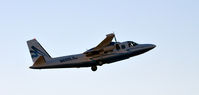
Aircraft
Rockwell Grand Commander 690Registration
N690LS
MSN
690-11475
Year of Manufacture
1978
Operator
Surdex CorporationDate
September 28, 2021 at 09:00 AM
Type
CRASHFlight Type
Geographical / Geophysical / Scientific
Flight Phase
Flight
Crash Site
Plain, Valley
Crash Location
Butternut Lake Wisconsin
Region
North America • United States of America
Coordinates
45.9704°, -90.5197°
Narrative Report
On September 28, 2021 at 09:00 AM, Rhinelander - Rhinelander experienced a crash involving Rockwell Grand Commander 690, operated by Surdex Corporation, with the event recorded near Butternut Lake Wisconsin.
The flight was categorized as geographical / geophysical / scientific and the reported phase was flight at a plain, valley crash site.
3 people were known to be on board, 3 fatalities were recorded, 0 survivors were identified or estimated. This corresponds to an estimated fatality rate of 100.0%.
Crew on board: 1, crew fatalities: 1, passengers on board: 2, passenger fatalities: 2, other fatalities: 0.
On September 28, 2021, about 0900 central daylight time, a Rockwell International 690B airplane, N690LS, was destroyed when it was involved in an accident near Hiles, Wisconsin. The pilot and two passengers sustained fatal injuries. The airplane was operated as a Title 14 Code of Federal Regulations Part 91 aerial imagery survey flight. According to the operator, the flight mission was to obtain aerial imagery of the forest vegetation for the Wisconsin Department of Natural Resources. Preliminary automatic dependent surveillance-broadcast information (ADS-B) revealed the airplane departed the Rhinelander-Oneida County Airport, Rhinelander, Wisconsin, about 0850. About 0858, the airplane began to level off about 15,600 ft with a maximum groundspeed of 209 knots (kts). Between 0858 and 0900, the airplane continued level flight; however, the groundspeed decreased to about 93 kts. The ADS-B data ended at 0900:56. According to air traffic control, a “mayday, mayday, mayday…we’re in a spin” transmission was broadcast. The airplane was not under air traffic control during the flight or at the time of the accident. A witness, located about one mile from the accident site, reported he heard a “loud, strange sounding airplane.” He looked up and noticed an airplane “nose down at high rate of speed spinning about its longitudinal axis at about 30 to 60 rpm.” The witness lost sight of the airplane behind some trees and then heard an impact. The airplane wreckage was located during an aerial and ground search in wetlands and wooded terrain about 10 miles east of Eagle River, Wisconsin, and 1 mile west of Butternut Lake, in the Chequamegon-Nicolet National Forest. The wreckage was distributed in a diameter of about 50 yards. A majority of the main wreckage was found beneath the water surface with some debris located in the trees.
Aircraft reference details include registration N690LS, MSN 690-11475, year of manufacture 1978.
Geospatial coordinates for this crash are approximately 45.9704°, -90.5197°.
Fatalities
Total
3
Crew
1
Passengers
2
Other
0
Crash Summary
On September 28, 2021, about 0900 central daylight time, a Rockwell International 690B airplane, N690LS, was destroyed when it was involved in an accident near Hiles, Wisconsin. The pilot and two passengers sustained fatal injuries. The airplane was operated as a Title 14 Code of Federal Regulations Part 91 aerial imagery survey flight. According to the operator, the flight mission was to obtain aerial imagery of the forest vegetation for the Wisconsin Department of Natural Resources. Preliminary automatic dependent surveillance-broadcast information (ADS-B) revealed the airplane departed the Rhinelander-Oneida County Airport, Rhinelander, Wisconsin, about 0850. About 0858, the airplane began to level off about 15,600 ft with a maximum groundspeed of 209 knots (kts). Between 0858 and 0900, the airplane continued level flight; however, the groundspeed decreased to about 93 kts. The ADS-B data ended at 0900:56. According to air traffic control, a “mayday, mayday, mayday…we’re in a spin” transmission was broadcast. The airplane was not under air traffic control during the flight or at the time of the accident. A witness, located about one mile from the accident site, reported he heard a “loud, strange sounding airplane.” He looked up and noticed an airplane “nose down at high rate of speed spinning about its longitudinal axis at about 30 to 60 rpm.” The witness lost sight of the airplane behind some trees and then heard an impact. The airplane wreckage was located during an aerial and ground search in wetlands and wooded terrain about 10 miles east of Eagle River, Wisconsin, and 1 mile west of Butternut Lake, in the Chequamegon-Nicolet National Forest. The wreckage was distributed in a diameter of about 50 yards. A majority of the main wreckage was found beneath the water surface with some debris located in the trees.
Occupants & Outcome
Crew On Board
1
Passengers On Board
2
Estimated Survivors
0
Fatality Rate
100.0%
Known people on board: 3
Operational Details
Schedule / Flight
Rhinelander - Rhinelander
Operator
Surdex CorporationFlight Type
Geographical / Geophysical / Scientific
Flight Phase
Flight
Crash Site
Plain, Valley
Region / Country
North America • United States of America
Aircraft Details
Similar Plane Crashes
United States Signal Corps - USSC
De Havilland DH.4
The single engine airplane departed Dayton-McCook Field for a local test flight. Shortly after takeoff, the aircraft stalled and crashed, killing both occupants. Crew: Maj Oscar Brindley, Lt Col Henry Damm.
United States Signal Corps - USSC
De Havilland DH.4
Lt. Frank Stuart Patterson, son and nephew of the co-founders of National Cash Register, is killed in the crash of his DH.4M, AS-32098, at Wilbur Wright Field during a flight test of a new mechanism for synchronizing machine gun and propeller, when a tie rod breaks during a dive from 15,000 feet (4,600 m), causing the wings to separate from the aircraft. Wishing to recognize the contributions of the Patterson family (owners of NCR) the area of Wright Field east of Huffman Dam (including Wilbur Wright Field, Fairfield Air Depot, and the Huffman Prairie) is renamed Patterson Field on 6 July 1931, in honor of Lt. Patterson.
United States Signal Corps - USSC
De Havilland DH.4
The aircraft crashed in unknown circumstances.
United States Signal Corps - USSC
De Havilland DH.4
The crew was completing a training mission. At an altitude of about 4,000 feet, the aircraft entered a spin and crashed in an open field near Everman-Barron Field Airport. A crew was killed and the second occupants was injured. The aircraft was destroyed.
U.S. Air Mail Service
De Havilland DH.4
Crashed following an engine failure. Pilot fate unknown.
United States Signal Corps - USSC
De Havilland DH.4
The accident occurred in unknown circumstances.