Monterey – Salinas
Flight / Schedule
Monterey – Salinas
Aircraft
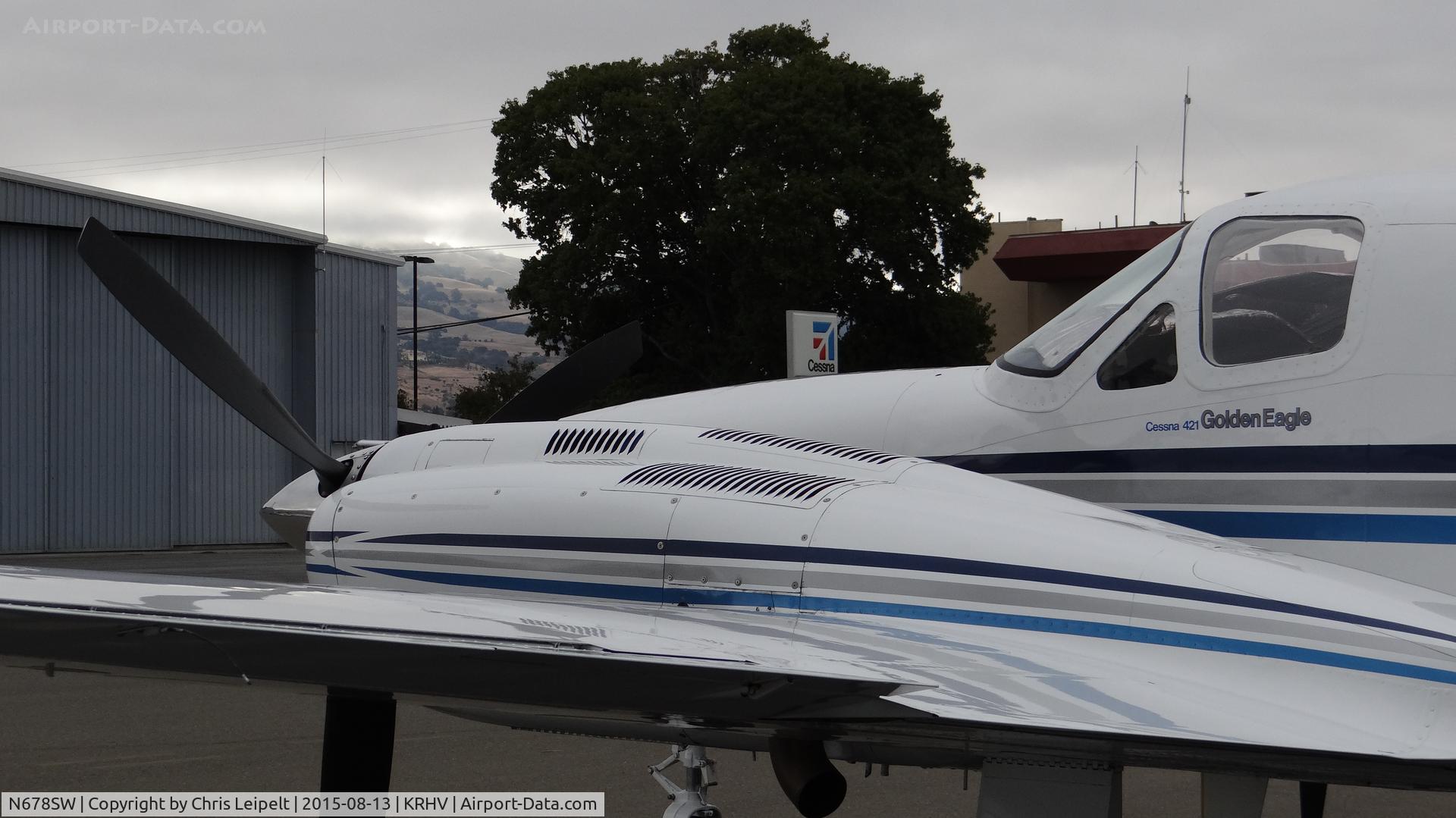
Cessna 421C Golden Eagle IIIRegistration
N678SW
MSN
421C-1023
Year of Manufacture
1981
Operator
M. E. MullalyDate
July 13, 2021 at 10:42 AM
Type
CRASHFlight Type
Private
Flight Phase
Takeoff (climb)
Crash Site
City
Crash Location
Monterey California
Region
North America • United States of America
Coordinates
36.6392°, -121.8150°
Narrative Report
On July 13, 2021 at 10:42 AM, Monterey – Salinas experienced a crash involving Cessna 421C Golden Eagle III, operated by M. E. Mullaly, with the event recorded near Monterey California.
The flight was categorized as private and the reported phase was takeoff (climb) at a city crash site.
1 people were known to be on board, 1 fatalities were recorded, 0 survivors were identified or estimated. This corresponds to an estimated fatality rate of 100.0%.
Crew on board: 1, crew fatalities: 1, passengers on board: 0, passenger fatalities: 0, other fatalities: 0.
On July 13, 2021 about 1042 Pacific daylight time, a Cessna 421C, N678SW, was destroyed when it was involved in an accident near Monterey, California. The pilot and passenger were fatally injured. The airplane was operated as a Title 14 Code of Federal Regulations Part 91 personal flight. Review of recorded communication from the Monterey air traffic control tower revealed that the pilot canceled their initial instrument flight rules (IFR) clearance and requested a Visual Flight Rules (VFR) on top clearance. The controller subsequently issued a VFR-ON-TOP clearance via the Monterey Five departure procedure, which included instructions to turn left after takeoff to join the Salinas very high frequency omni directional range (VOR) 264° radial. The controller issued a clearance for takeoff and shortly after, instructed the pilot to contact the Oakland Air Route Traffic Control Center (ARTCC). Review of recorded communication from the Oakland ARTCC revealed that the pilot established radio communication with the Oakland ARTCC controller as the airplane ascended through 1,700 ft msl. The controller noticed the airplane was turning in the wrong direction and issued an immediate right turn to a heading of 030° which was acknowledged by the pilot. The controller then immediately issued two low altitude alerts with no response from the pilot. No further radio communication with the pilot was received. Recorded Automatic Dependent Surveillance-Broadcast (ADS-B) data provided by the Federal Aviation Administration (FAA) showed that the airplane departed from runway 10R at 1738:44 and ascended to 1,075 ft msl before a right turn was initiated. The data showed that at 1740:14, the airplane continued to ascend in a right turn and reached an altitude of 2,000 ft msl before a descent began. The data showed that the airplane continued descending right turn until ADS-B contact was lost at 1740:38, at an altitude of 775 ft, about 520 ft southwest of the accident site. A witness located near the accident site reported that he observed the accident airplane descend below the cloud layer in a nose low attitude with the landing gear retracted. The witness stated that the airplane made a right descending turn and impacted the top of a pine tree before it traveled below the tree line, followed by the sound of an explosion. The preliminary weather for the MRY airport reported that at 1054 PDT, winds from 280° at 7 knots, visibility of 9 statute miles, ceiling overcast at 800 feet agl, temperature of 15°C and dew point temperature of 11°C, altimeter setting of 29.99 inches of mercury, remarks included: station with a precipitation discriminator. Examination of the accident site revealed that the airplane impacted trees about 1 mile south of the departure end of runway 10R. The first identifiable point of contact (FIPC) was a 50 to 75 ft tall tree that had damaged limbs near the top of the tree. The debris path was oriented on a heading of about 067° and was about 995 ft in length from the FIPC, as seen in figure 2. The main wreckage was located about 405 ft from the FIPC. Various portions of aluminum wing skin, right wing, flap, aileron, engine, propeller blades, and propeller hub were observed throughout the debris path. Additionally, several trees were damaged throughout the debris path. The fuselage came to rest upright against a residential structure on a heading of about 045° magnetic at an elevation of 447 ft msl. The wreckage was recovered to a secure location for further examination.
Aircraft reference details include registration N678SW, MSN 421C-1023, year of manufacture 1981.
Geospatial coordinates for this crash are approximately 36.6392°, -121.8150°.
Fatalities
Total
1
Crew
1
Passengers
0
Other
0
Crash Summary
On July 13, 2021 about 1042 Pacific daylight time, a Cessna 421C, N678SW, was destroyed when it was involved in an accident near Monterey, California. The pilot and passenger were fatally injured. The airplane was operated as a Title 14 Code of Federal Regulations Part 91 personal flight. Review of recorded communication from the Monterey air traffic control tower revealed that the pilot canceled their initial instrument flight rules (IFR) clearance and requested a Visual Flight Rules (VFR) on top clearance. The controller subsequently issued a VFR-ON-TOP clearance via the Monterey Five departure procedure, which included instructions to turn left after takeoff to join the Salinas very high frequency omni directional range (VOR) 264° radial. The controller issued a clearance for takeoff and shortly after, instructed the pilot to contact the Oakland Air Route Traffic Control Center (ARTCC). Review of recorded communication from the Oakland ARTCC revealed that the pilot established radio communication with the Oakland ARTCC controller as the airplane ascended through 1,700 ft msl. The controller noticed the airplane was turning in the wrong direction and issued an immediate right turn to a heading of 030° which was acknowledged by the pilot. The controller then immediately issued two low altitude alerts with no response from the pilot. No further radio communication with the pilot was received. Recorded Automatic Dependent Surveillance-Broadcast (ADS-B) data provided by the Federal Aviation Administration (FAA) showed that the airplane departed from runway 10R at 1738:44 and ascended to 1,075 ft msl before a right turn was initiated. The data showed that at 1740:14, the airplane continued to ascend in a right turn and reached an altitude of 2,000 ft msl before a descent began. The data showed that the airplane continued descending right turn until ADS-B contact was lost at 1740:38, at an altitude of 775 ft, about 520 ft southwest of the accident site. A witness located near the accident site reported that he observed the accident airplane descend below the cloud layer in a nose low attitude with the landing gear retracted. The witness stated that the airplane made a right descending turn and impacted the top of a pine tree before it traveled below the tree line, followed by the sound of an explosion. The preliminary weather for the MRY airport reported that at 1054 PDT, winds from 280° at 7 knots, visibility of 9 statute miles, ceiling overcast at 800 feet agl, temperature of 15°C and dew point temperature of 11°C, altimeter setting of 29.99 inches of mercury, remarks included: station with a precipitation discriminator. Examination of the accident site revealed that the airplane impacted trees about 1 mile south of the departure end of runway 10R. The first identifiable point of contact (FIPC) was a 50 to 75 ft tall tree that had damaged limbs near the top of the tree. The debris path was oriented on a heading of about 067° and was about 995 ft in length from the FIPC, as seen in figure 2. The main wreckage was located about 405 ft from the FIPC. Various portions of aluminum wing skin, right wing, flap, aileron, engine, propeller blades, and propeller hub were observed throughout the debris path. Additionally, several trees were damaged throughout the debris path. The fuselage came to rest upright against a residential structure on a heading of about 045° magnetic at an elevation of 447 ft msl. The wreckage was recovered to a secure location for further examination.
Occupants & Outcome
Crew On Board
1
Passengers On Board
0
Estimated Survivors
0
Fatality Rate
100.0%
Known people on board: 1
Operational Details
Schedule / Flight
Monterey – Salinas
Operator
M. E. MullalyFlight Type
Private
Flight Phase
Takeoff (climb)
Crash Site
City
Region / Country
North America • United States of America
Aircraft Details
Similar Plane Crashes
United States Signal Corps - USSC
De Havilland DH.4
The single engine airplane departed Dayton-McCook Field for a local test flight. Shortly after takeoff, the aircraft stalled and crashed, killing both occupants. Crew: Maj Oscar Brindley, Lt Col Henry Damm.
United States Signal Corps - USSC
De Havilland DH.4
Lt. Frank Stuart Patterson, son and nephew of the co-founders of National Cash Register, is killed in the crash of his DH.4M, AS-32098, at Wilbur Wright Field during a flight test of a new mechanism for synchronizing machine gun and propeller, when a tie rod breaks during a dive from 15,000 feet (4,600 m), causing the wings to separate from the aircraft. Wishing to recognize the contributions of the Patterson family (owners of NCR) the area of Wright Field east of Huffman Dam (including Wilbur Wright Field, Fairfield Air Depot, and the Huffman Prairie) is renamed Patterson Field on 6 July 1931, in honor of Lt. Patterson.
United States Signal Corps - USSC
De Havilland DH.4
The aircraft crashed in unknown circumstances.
United States Signal Corps - USSC
De Havilland DH.4
The crew was completing a training mission. At an altitude of about 4,000 feet, the aircraft entered a spin and crashed in an open field near Everman-Barron Field Airport. A crew was killed and the second occupants was injured. The aircraft was destroyed.
U.S. Air Mail Service
De Havilland DH.4
Crashed following an engine failure. Pilot fate unknown.
United States Signal Corps - USSC
De Havilland DH.4
The accident occurred in unknown circumstances.