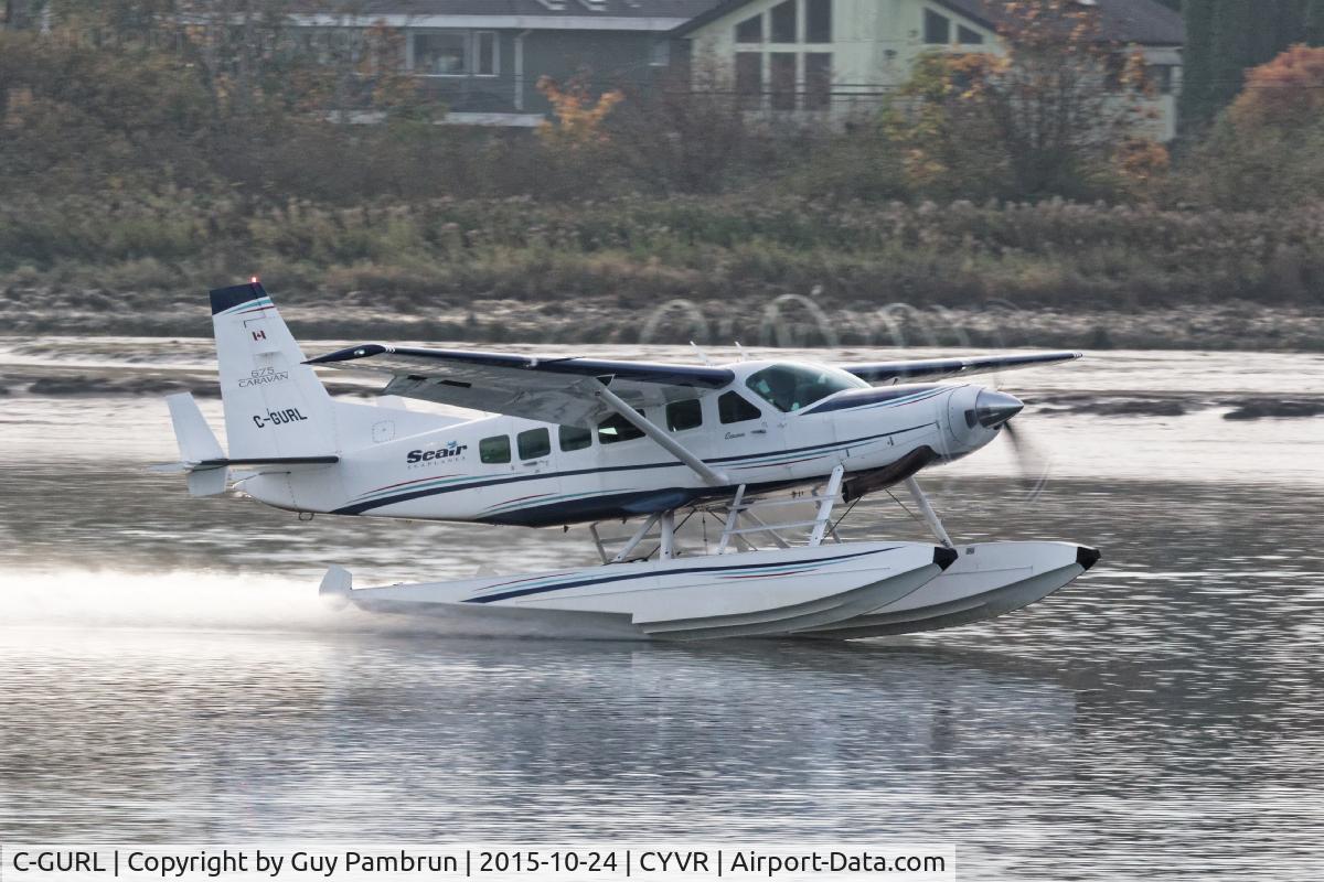
C-GURL
Flight / Schedule
C-GURL
Aircraft
Cessna 208A CaravanRegistration
C-GURL
MSN
208-0501
Year of Manufacture
2008
Operator
Seair Seaplanes - Seair ServicesDate
July 26, 2019 at 11:04 AM
Type
CRASHFlight Type
Charter/Taxi (Non Scheduled Revenue Flight)
Flight Phase
Flight
Crash Site
Mountains
Crash Location
Addenbroke Island British Columbia
Region
North America • Canada
Coordinates
51.6055°, -127.8463°
Crash Cause
Human factor
Narrative Report
On July 26, 2019 at 11:04 AM, C-GURL experienced a crash involving Cessna 208A Caravan, operated by Seair Seaplanes - Seair Services, with the event recorded near Addenbroke Island British Columbia.
The flight was categorized as charter/taxi (non scheduled revenue flight) and the reported phase was flight at a mountains crash site.
9 people were known to be on board, 4 fatalities were recorded, 5 survivors were identified or estimated. This corresponds to an estimated fatality rate of 44.4%.
Crew on board: 1, crew fatalities: 1, passengers on board: 8, passenger fatalities: 3, other fatalities: 0.
The listed crash cause is human factor. Seair Seaplanes (Seair) was contracted by a remote fishing lodge on the central coast of British Columbia (BC) (Figure 1) to provide seasonal transport of guests and supplies between Vancouver International Water Aerodrome (CAM9), BC, and the lodge, which is located about 66 nautical miles (NM) north-northwest of Port Hardy Airport (CYZT), BC, and about 29 NM southeast of Bella Bella (Campbell Island) Airport (CBBC), BC. On 26 July 2019, the occurrence pilot arrived at Seair’s CAM9 base at approximately 0630. Over the next hour, the pilot completed a daily inspection of the Cessna 208 Caravan aircraft (registration C-GURL, serial number 20800501), added 300 L of fuel to the aircraft, and began flight planning activities, which included gathering and interpreting weather information. On the morning of the occurrence, 4 Seair visual flight rules (VFR) flights were scheduled to fly to the central coast of BC, all on Caravan aircraft: C-GURL (the occurrence aircraft) was to depart CAM9 at 0730, C-GSAS at 0745, C-FLAC at 0800, and C-GUUS at 0900. The first 3 flights were direct flights to the fishing lodge, while the 4th flight had an intermediate stop at the Campbell River Water Aerodrome (CAE3), BC, to pick up passengers before heading to a research institute located approximately 4 NM southwest of the fishing lodge. Because of poor weather conditions in the central coast region, however, all of the flights were delayed. After the crews referred to weather cameras along the central coast region, the flights began to depart, but in a different order than originally scheduled. It is not uncommon for the order of departure to change when groups of aircraft are going to the same general location. One of Seair’s senior operational staff (operations manager) departed CAM9 at 0850 aboard C-FLAC. C-GUUS, bound for the research institute, departed CAM9 next at 0906, and then the occurrence aircraft departed at 0932 (Table 1). The pilot originally scheduled to fly C-GSAS declined the flight. This pilot had recently upgraded to the Caravan, had never flown to this destination before, and was concerned about the weather at the destination. When Seair’s chief pilot returned to CAM9 at 0953 after a series of scheduled flights on a different type of aircraft, he assumed the last remaining flight to the lodge and C-GSAS departed CAM9 at 1024.After departing the Vancouver terminal control area, the occurrence aircraft climbed to 4500 feet above sea level (ASL) and remained at this altitude until 1023, when a slow descent was initiated. The aircraft levelled off at approximately 1300 feet ASL at 1044, when it was approximately 18 NM northeast of Port Hardy Airport (CYZT), BC, and 57 NM southeast of the destination. At 1050, the occurrence aircraft slowly descended again as the flight continued northbound. During this descent, the aircraft’s flaps were extended to the 10° position. At this point, the occurrence aircraft was 37 NM south-southeast of the fishing lodge. The aircraft continued to descend until it reached an altitude of approximately 330 feet ASL, at 1056. By this point, the occurrence aircraft was being operated along the coastline, but over the ocean. C-FLAC departed from the fishing lodge at 1056 on the return flight to CAM9. C-FLAC flew into the Fitz Hugh Sound and proceeded southbound along the western shoreline. At approximately 1100, it flew through an area of heavy rain where visibility was reduced to about 1 statute mile (SM). C-FLAC descended to about 170 feet ASL and maintained this altitude for the next 5 minutes before climbing to about 300 feet ASL. As the southbound C-FLAC entered Fitz Hugh Sound from the north at Hecate Island, the occurrence aircraft entered Fitz Hugh Sound from the south, near the southern tip of Calvert Island. The occurrence aircraft then changed course from the western to the eastern shoreline, and descended again to about 230 feet ASL (Figure 2), while maintaining an airspeed of approximately 125 knots. The 2 aircraft established 2-way radio contact. The pilot of C-FLAC indicated that Addenbroke Island was visible when he flew past it, and described the weather conditions in the Fitz Hugh Sound to the occurrence pilot as heavy rain showers and visibility of approximately 1 SM around Kelpie Point. The occurrence pilot then indicated that he would maintain a course along the eastern shoreline of the sound. At 1103, the 2 aircraft were separated by 2 NM and passed each other on reciprocal tracks, approximately 4 NM south of the accident site. The occurrence aircraft maintained a consistent track and altitude for the next 54 seconds, then slowly began a 25° change in track to the west (0.35 NM from the Addenbroke Island shoreline). Seven seconds after the turn started (0.12 NM from the island’s shoreline), the aircraft entered a shallow climb averaging 665 fpm. At 1104:55, the occurrence aircraft struck trees on Addenbroke Island at an altitude of approximately 490 feet ASL, at an airspeed of 114 knots, and in a relatively straight and level attitude. The aircraft then continued through the heavily forested hillside for approximately 450 feet, coming to rest at an elevation of 425 feet ASL, 9.7 NM east-southeast of the destination fishing lodge. The pilot and three passengers were killed and five other occupants were injured, four seriously.
Aircraft reference details include registration C-GURL, MSN 208-0501, year of manufacture 2008.
Geospatial coordinates for this crash are approximately 51.6055°, -127.8463°.
Fatalities
Total
4
Crew
1
Passengers
3
Other
0
Crash Summary
Seair Seaplanes (Seair) was contracted by a remote fishing lodge on the central coast of British Columbia (BC) (Figure 1) to provide seasonal transport of guests and supplies between Vancouver International Water Aerodrome (CAM9), BC, and the lodge, which is located about 66 nautical miles (NM) north-northwest of Port Hardy Airport (CYZT), BC, and about 29 NM southeast of Bella Bella (Campbell Island) Airport (CBBC), BC. On 26 July 2019, the occurrence pilot arrived at Seair’s CAM9 base at approximately 0630. Over the next hour, the pilot completed a daily inspection of the Cessna 208 Caravan aircraft (registration C-GURL, serial number 20800501), added 300 L of fuel to the aircraft, and began flight planning activities, which included gathering and interpreting weather information. On the morning of the occurrence, 4 Seair visual flight rules (VFR) flights were scheduled to fly to the central coast of BC, all on Caravan aircraft: C-GURL (the occurrence aircraft) was to depart CAM9 at 0730, C-GSAS at 0745, C-FLAC at 0800, and C-GUUS at 0900. The first 3 flights were direct flights to the fishing lodge, while the 4th flight had an intermediate stop at the Campbell River Water Aerodrome (CAE3), BC, to pick up passengers before heading to a research institute located approximately 4 NM southwest of the fishing lodge. Because of poor weather conditions in the central coast region, however, all of the flights were delayed. After the crews referred to weather cameras along the central coast region, the flights began to depart, but in a different order than originally scheduled. It is not uncommon for the order of departure to change when groups of aircraft are going to the same general location. One of Seair’s senior operational staff (operations manager) departed CAM9 at 0850 aboard C-FLAC. C-GUUS, bound for the research institute, departed CAM9 next at 0906, and then the occurrence aircraft departed at 0932 (Table 1). The pilot originally scheduled to fly C-GSAS declined the flight. This pilot had recently upgraded to the Caravan, had never flown to this destination before, and was concerned about the weather at the destination. When Seair’s chief pilot returned to CAM9 at 0953 after a series of scheduled flights on a different type of aircraft, he assumed the last remaining flight to the lodge and C-GSAS departed CAM9 at 1024.After departing the Vancouver terminal control area, the occurrence aircraft climbed to 4500 feet above sea level (ASL) and remained at this altitude until 1023, when a slow descent was initiated. The aircraft levelled off at approximately 1300 feet ASL at 1044, when it was approximately 18 NM northeast of Port Hardy Airport (CYZT), BC, and 57 NM southeast of the destination. At 1050, the occurrence aircraft slowly descended again as the flight continued northbound. During this descent, the aircraft’s flaps were extended to the 10° position. At this point, the occurrence aircraft was 37 NM south-southeast of the fishing lodge. The aircraft continued to descend until it reached an altitude of approximately 330 feet ASL, at 1056. By this point, the occurrence aircraft was being operated along the coastline, but over the ocean. C-FLAC departed from the fishing lodge at 1056 on the return flight to CAM9. C-FLAC flew into the Fitz Hugh Sound and proceeded southbound along the western shoreline. At approximately 1100, it flew through an area of heavy rain where visibility was reduced to about 1 statute mile (SM). C-FLAC descended to about 170 feet ASL and maintained this altitude for the next 5 minutes before climbing to about 300 feet ASL. As the southbound C-FLAC entered Fitz Hugh Sound from the north at Hecate Island, the occurrence aircraft entered Fitz Hugh Sound from the south, near the southern tip of Calvert Island. The occurrence aircraft then changed course from the western to the eastern shoreline, and descended again to about 230 feet ASL (Figure 2), while maintaining an airspeed of approximately 125 knots. The 2 aircraft established 2-way radio contact. The pilot of C-FLAC indicated that Addenbroke Island was visible when he flew past it, and described the weather conditions in the Fitz Hugh Sound to the occurrence pilot as heavy rain showers and visibility of approximately 1 SM around Kelpie Point. The occurrence pilot then indicated that he would maintain a course along the eastern shoreline of the sound. At 1103, the 2 aircraft were separated by 2 NM and passed each other on reciprocal tracks, approximately 4 NM south of the accident site. The occurrence aircraft maintained a consistent track and altitude for the next 54 seconds, then slowly began a 25° change in track to the west (0.35 NM from the Addenbroke Island shoreline). Seven seconds after the turn started (0.12 NM from the island’s shoreline), the aircraft entered a shallow climb averaging 665 fpm. At 1104:55, the occurrence aircraft struck trees on Addenbroke Island at an altitude of approximately 490 feet ASL, at an airspeed of 114 knots, and in a relatively straight and level attitude. The aircraft then continued through the heavily forested hillside for approximately 450 feet, coming to rest at an elevation of 425 feet ASL, 9.7 NM east-southeast of the destination fishing lodge. The pilot and three passengers were killed and five other occupants were injured, four seriously.
Cause: Human factor
Occupants & Outcome
Crew On Board
1
Passengers On Board
8
Estimated Survivors
5
Fatality Rate
44.4%
Known people on board: 9
Operational Details
Operator
Seair Seaplanes - Seair ServicesFlight Type
Charter/Taxi (Non Scheduled Revenue Flight)
Flight Phase
Flight
Crash Site
Mountains
Region / Country
North America • Canada
Aircraft Details
Similar Plane Crashes
Royal Canadian Air Force - RCAF
Avro 504
The pilot, sole on board, was completing a local training flight at Camp Borden Airport. The airplane crashed on takeoff. The pilot was rescued.
Royal Canadian Air Force - RCAF
De Havilland DH.9
Crashed in unknown circumstances.
Canadian Aircraft Company
Avro 504
On approach to Fort Frances, the aircraft stalled and crashed. Both occupants were injured.
Bishop-Barker Aeroplanes
Curtiss HS-2L
Hit tree tops and crashed in Brooklin, north of Oshawa, Ontario. Crew fate unknown.
Vancouver Island Aerial Service
Curtiss JN-4
En route from Alert Bay to Prince Rupert, the pilot Lt Harry W. Brown encountered an unexpected situation and was forced to ditch the aircraft off Nalau Island. He survived by paddling a log into the shipping lane and was picked up by a passing Alaskan steamer. The aircraft was lost.
Royal Canadian Air Force - RCAF
De Havilland DH.9
Crashed in unknown circumstances. Crew fate unknown.