Akron – Pawtucket
Flight / Schedule
Akron – Pawtucket
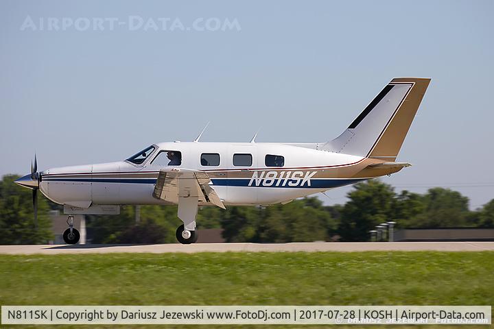
Registration
N811SK
MSN
46-8508046
Year of Manufacture
1985
Operator
Akron AerostarDate
July 19, 2019 at 02:40 PM
Type
CRASHFlight Type
Private
Flight Phase
Landing (descent or approach)
Crash Site
Airport (less than 10 km from airport)
Crash Location
Poughkeepsie-Hudson Valley (ex Dutchess County) New York
Region
North America • United States of America
Crash Cause
Technical failure
Narrative Report
On July 19, 2019 at 02:40 PM, Akron – Pawtucket experienced a crash involving Piper PA-46 (Malibu/Meridian/Mirage/Matrix/M-Class), operated by Akron Aerostar, with the event recorded near Poughkeepsie-Hudson Valley (ex Dutchess County) New York.
The flight was categorized as private and the reported phase was landing (descent or approach) at a airport (less than 10 km from airport) crash site.
4 people were known to be on board, 0 fatalities were recorded, 4 survivors were identified or estimated. This corresponds to an estimated fatality rate of 0.0%.
Crew on board: 1, crew fatalities: 0, passengers on board: 3, passenger fatalities: 0, other fatalities: 0.
The listed crash cause is technical failure. On July 19, 2019, about 1440 eastern daylight time, a Piper PA46-310P, N811SK, was substantially damaged during a forced landing while on approach to Hudson Valley Regional Airport (POU), Poughkeepsie, New York. The private pilot and two passengers were seriously injured, and one passenger sustained minor injuries. Visual meteorological conditions prevailed, and an instrument flight rules flight plan was filed for the flight that originated at Akron-Fulton International Airport (AKR), Akron, Ohio, about 1248. The airplane was owned and operated by the pilot under the provisions of Title 14 Code of Federal Regulations Part 91. The personal flight was originally destined for North Central State Airport (SFZ), Pawtucket, Rhode Island. Preliminary radar and voice communication data obtained from the Federal Aviation Administration (FAA) revealed that the airplane departed AKR, and about 25 minutes later had climbed to 19,000 ft, where it remained in cruise flight for about 1 hour and 10 minutes on a heading between 080 and 085°. At 1428:21, the pilot requested a diversion from his filed destination to POU to utilize a restroom. The Boston air route traffic control center controller approved the diversion to POU and issued altitude and heading clearances. About 1432, the radar target identified as the accident airplane had descended to 13,200 ft, where it turned slightly right and tracked directly toward POU. At 1433:38, the airplane was located 2 miles west of POU, about 12,000 ft, and in communication with the New York Terminal Radar Approach Control when the pilot stated, "…we are getting a ah fuel emergency light at this time so ah just want to expedite our approach in there." The controller acknowledged the low fuel warning and cleared the airplane to descend from its assigned altitude of 6,000 ft to 3,000 ft. The airplane crossed directly over POU at 11,700 ft and continued its easterly heading. At 1435:37, the airplane was about 5 miles east of POU at 8,100 ft, when the pilot requested a turn back to the airport. At 1435:46, the controller advised a direct turn back at "your discretion," and 2 minutes later cleared the airplane for a visual approach. At 1436:32, the airplane was at an altitude of 6,300 ft and about halfway through the course reversal back to POU, which was 7.4 miles to the west. Sky Acres Airport (44N), Lagrangeville, New York was 3.7 miles directly in front of the airplane at that time. After completing the course reversal, the airplane tracked parallel to its eastbound track on a westerly heading. At 1437:46, about 5 miles northeast of POU at 3,550 ft, the pilot advised the POU tower controller that he was performing a visual approach to runway 24. At 1438:44, 2 miles northeast of the airport about 1,500 ft, the airplane turned towards POU as it intercepted the inbound course to the landing runway. At 1439:32, the tower controller advised the airplane that its landing gear appeared to be retracted. The pilot responded, "we are too low we are not going to make it." There were no further communications with the airplane, and the final radar target was depicted at 350 ft about .75 miles from the landing runway which was at 163 ft elevation. The pilot held a private pilot certificate with ratings for airplane single engine land, multiengine land and instrument airplane. His most recent FAA third class medical certificate was issued May 15, 2019 and he reported 1,300 total hours of flight experience on that date. At 1453, the weather recorded at POU included clear skies, 10 miles visibility, wind from 220° at 8 knots, gusting to 15 knots, temperature 3°C, dew point 23°C, and an altimeter setting of 29.82 inches of mercury. Initial examination of the airplane at the accident site was performed by an FAA inspector. The airplane came to rest upright among trees and brush. The was no evidence of fuel, no fuel spillage, and no odor of fuel. The location of the wreckage precluded further examination at the accident site. Examination of photographs provided by the sheriff's department revealed the airplane's right wing displayed significant impact damage, was separated at its root, and came to rest immediately adjacent to the fuselage. The left wing appeared attached and largely intact.
Aircraft reference details include registration N811SK, MSN 46-8508046, year of manufacture 1985.
Fatalities
Total
0
Crew
0
Passengers
0
Other
0
Crash Summary
On July 19, 2019, about 1440 eastern daylight time, a Piper PA46-310P, N811SK, was substantially damaged during a forced landing while on approach to Hudson Valley Regional Airport (POU), Poughkeepsie, New York. The private pilot and two passengers were seriously injured, and one passenger sustained minor injuries. Visual meteorological conditions prevailed, and an instrument flight rules flight plan was filed for the flight that originated at Akron-Fulton International Airport (AKR), Akron, Ohio, about 1248. The airplane was owned and operated by the pilot under the provisions of Title 14 Code of Federal Regulations Part 91. The personal flight was originally destined for North Central State Airport (SFZ), Pawtucket, Rhode Island. Preliminary radar and voice communication data obtained from the Federal Aviation Administration (FAA) revealed that the airplane departed AKR, and about 25 minutes later had climbed to 19,000 ft, where it remained in cruise flight for about 1 hour and 10 minutes on a heading between 080 and 085°. At 1428:21, the pilot requested a diversion from his filed destination to POU to utilize a restroom. The Boston air route traffic control center controller approved the diversion to POU and issued altitude and heading clearances. About 1432, the radar target identified as the accident airplane had descended to 13,200 ft, where it turned slightly right and tracked directly toward POU. At 1433:38, the airplane was located 2 miles west of POU, about 12,000 ft, and in communication with the New York Terminal Radar Approach Control when the pilot stated, "…we are getting a ah fuel emergency light at this time so ah just want to expedite our approach in there." The controller acknowledged the low fuel warning and cleared the airplane to descend from its assigned altitude of 6,000 ft to 3,000 ft. The airplane crossed directly over POU at 11,700 ft and continued its easterly heading. At 1435:37, the airplane was about 5 miles east of POU at 8,100 ft, when the pilot requested a turn back to the airport. At 1435:46, the controller advised a direct turn back at "your discretion," and 2 minutes later cleared the airplane for a visual approach. At 1436:32, the airplane was at an altitude of 6,300 ft and about halfway through the course reversal back to POU, which was 7.4 miles to the west. Sky Acres Airport (44N), Lagrangeville, New York was 3.7 miles directly in front of the airplane at that time. After completing the course reversal, the airplane tracked parallel to its eastbound track on a westerly heading. At 1437:46, about 5 miles northeast of POU at 3,550 ft, the pilot advised the POU tower controller that he was performing a visual approach to runway 24. At 1438:44, 2 miles northeast of the airport about 1,500 ft, the airplane turned towards POU as it intercepted the inbound course to the landing runway. At 1439:32, the tower controller advised the airplane that its landing gear appeared to be retracted. The pilot responded, "we are too low we are not going to make it." There were no further communications with the airplane, and the final radar target was depicted at 350 ft about .75 miles from the landing runway which was at 163 ft elevation. The pilot held a private pilot certificate with ratings for airplane single engine land, multiengine land and instrument airplane. His most recent FAA third class medical certificate was issued May 15, 2019 and he reported 1,300 total hours of flight experience on that date. At 1453, the weather recorded at POU included clear skies, 10 miles visibility, wind from 220° at 8 knots, gusting to 15 knots, temperature 3°C, dew point 23°C, and an altimeter setting of 29.82 inches of mercury. Initial examination of the airplane at the accident site was performed by an FAA inspector. The airplane came to rest upright among trees and brush. The was no evidence of fuel, no fuel spillage, and no odor of fuel. The location of the wreckage precluded further examination at the accident site. Examination of photographs provided by the sheriff's department revealed the airplane's right wing displayed significant impact damage, was separated at its root, and came to rest immediately adjacent to the fuselage. The left wing appeared attached and largely intact.
Cause: Technical failure
Occupants & Outcome
Crew On Board
1
Passengers On Board
3
Estimated Survivors
4
Fatality Rate
0.0%
Known people on board: 4
Operational Details
Schedule / Flight
Akron – Pawtucket
Operator
Akron AerostarFlight Type
Private
Flight Phase
Landing (descent or approach)
Crash Site
Airport (less than 10 km from airport)
Region / Country
North America • United States of America
Aircraft Details
Registration
N811SK
MSN
46-8508046
Year of Manufacture
1985
Similar Plane Crashes
United States Signal Corps - USSC
De Havilland DH.4
The single engine airplane departed Dayton-McCook Field for a local test flight. Shortly after takeoff, the aircraft stalled and crashed, killing both occupants. Crew: Maj Oscar Brindley, Lt Col Henry Damm.
United States Signal Corps - USSC
De Havilland DH.4
Lt. Frank Stuart Patterson, son and nephew of the co-founders of National Cash Register, is killed in the crash of his DH.4M, AS-32098, at Wilbur Wright Field during a flight test of a new mechanism for synchronizing machine gun and propeller, when a tie rod breaks during a dive from 15,000 feet (4,600 m), causing the wings to separate from the aircraft. Wishing to recognize the contributions of the Patterson family (owners of NCR) the area of Wright Field east of Huffman Dam (including Wilbur Wright Field, Fairfield Air Depot, and the Huffman Prairie) is renamed Patterson Field on 6 July 1931, in honor of Lt. Patterson.
United States Signal Corps - USSC
De Havilland DH.4
The aircraft crashed in unknown circumstances.
United States Signal Corps - USSC
De Havilland DH.4
The crew was completing a training mission. At an altitude of about 4,000 feet, the aircraft entered a spin and crashed in an open field near Everman-Barron Field Airport. A crew was killed and the second occupants was injured. The aircraft was destroyed.
U.S. Air Mail Service
De Havilland DH.4
Crashed following an engine failure. Pilot fate unknown.
United States Signal Corps - USSC
De Havilland DH.4
The accident occurred in unknown circumstances.