Tortola – San Juan
Flight / Schedule
Tortola – San Juan
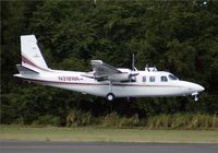
Aircraft
Rockwell Grand Commander 690Registration
N318WA
MSN
690-11444
Year of Manufacture
1978
Operator
Websta's Aviation ServicesDate
December 3, 2008 at 12:05 PM
Type
CRASHFlight Type
Charter/Taxi (Non Scheduled Revenue Flight)
Flight Phase
Flight
Crash Site
Mountains
Crash Location
El Yunque National Forest All Puerto Rico
Region
Central America • Puerto Rico
Crash Cause
Human factor
Narrative Report
On December 3, 2008 at 12:05 PM, Tortola – San Juan experienced a crash involving Rockwell Grand Commander 690, operated by Websta's Aviation Services, with the event recorded near El Yunque National Forest All Puerto Rico.
The flight was categorized as charter/taxi (non scheduled revenue flight) and the reported phase was flight at a mountains crash site.
3 people were known to be on board, 3 fatalities were recorded, 0 survivors were identified or estimated. This corresponds to an estimated fatality rate of 100.0%.
Crew on board: 1, crew fatalities: 1, passengers on board: 2, passenger fatalities: 2, other fatalities: 0.
The listed crash cause is human factor. The charter flight departed for the destination, where the passengers would connect with another airline flight. The instrument-rated pilot may have felt pressured as the flight departed late. The accident airplane approached the destination airport from the east, descending at 250 knots ground speed from 8,800 feet above mean sea level (msl), on a 270 degree assigned heading, and was instructed to enter the right downwind for runway 10. The airplane's altitude readout was then observed by the approach controller to change to "XXX." The pilot was queried regarding his altitude and he advised that he was descending to 3,200 feet msl. The pilot was asked to confirm that he was in visual flight rules (VFR) conditions and was advised that the minimum vectoring altitude (MVA) for the area was 5,500 feet msl. The pilot responded that “We just ahh,” at which time the controller advised that she missed his transmission and asked him to repeat it. The pilot stated “Ahh roger, could we stay right just a little, we are in and out of some clouds right now.” The controller advised the pilot to “Maintain VFR” and again of the MVA. The controller then made multiple attempts to contact the pilot without result. The wreckage was discovered on the side of a mountain, where the airplane impacted after entering instrument meteorological conditions. Because aircraft operating in VFR flight are not required to comply with minimum instrument altitudes, aircraft receiving VFR radar services are not automatically afforded Minimum Safe Altitude Warning services except by pilot request. The controller's query to the pilot about his altitude and flight conditions was based on her observation of the loss of altitude reporting information. The pilot had not indicated any difficulty in maintaining VFR flight or terrain clearance up to that point. His comment that the aircraft was "in and out of some clouds" was her first indication that the pilot was not operating in visual conditions, and came within seconds of impact with the terrain. The controller was engaged in trying to correct the situation, and despite having been advised of the minimum vectoring altitude, the pilot continued to descend. The airplane was equipped with a terrain avoidance warning system but it could not be determined if it was functional. The pilot owned the charter operation. Documents discovered in the wreckage identified the pilot and airplane as operating for a different company since the pilot did not have the permissions necessary to operate in the United Kingdom Overseas Territories.
Aircraft reference details include registration N318WA, MSN 690-11444, year of manufacture 1978.
Fatalities
Total
3
Crew
1
Passengers
2
Other
0
Crash Summary
The charter flight departed for the destination, where the passengers would connect with another airline flight. The instrument-rated pilot may have felt pressured as the flight departed late. The accident airplane approached the destination airport from the east, descending at 250 knots ground speed from 8,800 feet above mean sea level (msl), on a 270 degree assigned heading, and was instructed to enter the right downwind for runway 10. The airplane's altitude readout was then observed by the approach controller to change to "XXX." The pilot was queried regarding his altitude and he advised that he was descending to 3,200 feet msl. The pilot was asked to confirm that he was in visual flight rules (VFR) conditions and was advised that the minimum vectoring altitude (MVA) for the area was 5,500 feet msl. The pilot responded that “We just ahh,” at which time the controller advised that she missed his transmission and asked him to repeat it. The pilot stated “Ahh roger, could we stay right just a little, we are in and out of some clouds right now.” The controller advised the pilot to “Maintain VFR” and again of the MVA. The controller then made multiple attempts to contact the pilot without result. The wreckage was discovered on the side of a mountain, where the airplane impacted after entering instrument meteorological conditions. Because aircraft operating in VFR flight are not required to comply with minimum instrument altitudes, aircraft receiving VFR radar services are not automatically afforded Minimum Safe Altitude Warning services except by pilot request. The controller's query to the pilot about his altitude and flight conditions was based on her observation of the loss of altitude reporting information. The pilot had not indicated any difficulty in maintaining VFR flight or terrain clearance up to that point. His comment that the aircraft was "in and out of some clouds" was her first indication that the pilot was not operating in visual conditions, and came within seconds of impact with the terrain. The controller was engaged in trying to correct the situation, and despite having been advised of the minimum vectoring altitude, the pilot continued to descend. The airplane was equipped with a terrain avoidance warning system but it could not be determined if it was functional. The pilot owned the charter operation. Documents discovered in the wreckage identified the pilot and airplane as operating for a different company since the pilot did not have the permissions necessary to operate in the United Kingdom Overseas Territories.
Cause: Human factor
Occupants & Outcome
Crew On Board
1
Passengers On Board
2
Estimated Survivors
0
Fatality Rate
100.0%
Known people on board: 3
Operational Details
Schedule / Flight
Tortola – San Juan
Operator
Websta's Aviation ServicesFlight Type
Charter/Taxi (Non Scheduled Revenue Flight)
Flight Phase
Flight
Crash Site
Mountains
Region / Country
Central America • Puerto Rico
Aircraft Details
Similar Plane Crashes
Pan American World Airways - PAA
Loening C-W Air Yacht
While taking off from the bay in Puerto Rico, the seaplane hit an embankment and came to rest. Both crew members were rescued and the aircraft sank.
Pan American World Airways - PAA
Sikorsky S-38
Upon landing off San Juan, the floatplane collided with an undetermined floating object and was damaged beyond repair. All nine occupants were rescued.
United States Army Air Corps - USAAC
Sikorsky S-43
Crashed into the sea shortly after take off following an engine failure. Crew fate unknown.
Pan American World Airways - PAA
Sikorsky S-42
Following an uneventful flight, the crew completed the approach to the San Juan harbor in good weather conditions. Upon landing on water in a nose down attitude, the seaplane plunged into the water and came to rest. Two passengers were killed while all 25 other occupants were rescued. Crew: Charles A. Lorber, pilot, Harvey E. Breaux, copilot, John Donovan Donnelley, flight engineer, W. P. Mahoney, radio navigator, Joe Catala, steward, A. E. Calligari, steward. Source & photos: http://www.webstart.com/jed/house/NC15376/
United States Army Air Forces - USAAF
Consolidated B-24 Liberator
After touchdown at Borinquen Airport, the aircraft went out off control, veered off runway and came to rest in flames into an airport building. The crew fate remains unknown.
United States Army Air Forces - USAAF
Douglas C-39 (DC-2)
While flying in a valley in poor weather conditions, the aircraft hit a mountain shrouded in clouds. All 22 occupants were killed, among them three civilians. According to USAF, the aircraft hit the mountain slope sixty metres from the summit and the cloud base was around 1,200 metres. The twin engine aircraft was following a 150° heading and was flying at a cruising speed at the time of the accident. Crew: Francis H. Durant, pilot, 4.