Honolulu - Lihue
Flight / Schedule
Honolulu - Lihue
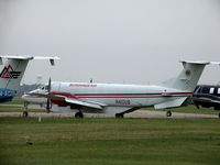
Aircraft
Beechcraft 1900CRegistration
N410UB
MSN
UC-070
Year of Manufacture
1989
Operator
Alpine AirDate
January 14, 2008 at 05:08 AM
Type
CRASHFlight Type
Postal (mail)
Flight Phase
Landing (descent or approach)
Crash Site
Airport (less than 10 km from airport)
Crash Location
Lihue Hawaii
Region
North America • United States of America
Coordinates
21.9770°, -159.3688°
Crash Cause
Human factor
Narrative Report
On January 14, 2008 at 05:08 AM, Honolulu - Lihue experienced a crash involving Beechcraft 1900C, operated by Alpine Air, with the event recorded near Lihue Hawaii.
The flight was categorized as postal (mail) and the reported phase was landing (descent or approach) at a airport (less than 10 km from airport) crash site.
1 people were known to be on board, 1 fatalities were recorded, 0 survivors were identified or estimated. This corresponds to an estimated fatality rate of 100.0%.
Crew on board: 1, crew fatalities: 1, passengers on board: 0, passenger fatalities: 0, other fatalities: 0.
The listed crash cause is human factor. The pilot was flying a night, single-pilot, cargo flight over water between two islands. He had routine contact with air traffic control, and was advised by the controller to maintain 6,000 feet at 0501 hours when the airplane was 11 miles from the destination airport. Two minutes later the flight was cleared for a visual approach to follow a preceding Boeing 737 and advised to switch to the common traffic advisory frequency at the airport. The destination airport was equipped with an air traffic control tower but it was closed overnight. The accident flight's radar-derived flight path showed that the pilot altered his flight course to the west, most likely for spacing from the airplane ahead, and descended into the water as he began a turn back toward the airport. The majority of the wreckage sank in 4,800 feet of water and was not recovered, so examinations and testing could not be performed. As a result, the functionality of the altitude and attitude instruments in the cockpit could not be determined. A performance study showed, however, that the airspeed, pitch, rates of descent, and bank angles of the airplane during the approach were within expected normal ranges, and the pilot did not make any transmissions during the approach that indicated he was having any problems. In fact, another cargo flight crew that landed just prior to the accident airplane and an airport employee reported that the pilot transmitted that he was landing on the active runway, and was 7 miles from landing. Radar data showed that when the airplane was 6.5 miles from the airport, at the location of the last recorded radar return, the radar target's mode C altitude report showed an altitude of minus 100 feet mean sea level. The pilot most likely descended into the ocean because he became spatially disoriented. Although visual meteorological conditions prevailed, no natural horizon and few external visual references were available during the visual approach. This increased the importance of monitoring flight instruments to maintain awareness of the airplane attitude and altitude. The pilot's tasks during the approach, however, included maintaining visual separation from the airplane ahead and lining up with the destination runway. These tasks required visual attention outside the cockpit. These competing tasks probably created shifting visual frames of reference, left the pilot vulnerable to common visual and vestibular illusions, and reduced his awareness of the airplane's attitude, altitude and trajectory.
Aircraft reference details include registration N410UB, MSN UC-070, year of manufacture 1989.
Geospatial coordinates for this crash are approximately 21.9770°, -159.3688°.
Fatalities
Total
1
Crew
1
Passengers
0
Other
0
Crash Summary
The pilot was flying a night, single-pilot, cargo flight over water between two islands. He had routine contact with air traffic control, and was advised by the controller to maintain 6,000 feet at 0501 hours when the airplane was 11 miles from the destination airport. Two minutes later the flight was cleared for a visual approach to follow a preceding Boeing 737 and advised to switch to the common traffic advisory frequency at the airport. The destination airport was equipped with an air traffic control tower but it was closed overnight. The accident flight's radar-derived flight path showed that the pilot altered his flight course to the west, most likely for spacing from the airplane ahead, and descended into the water as he began a turn back toward the airport. The majority of the wreckage sank in 4,800 feet of water and was not recovered, so examinations and testing could not be performed. As a result, the functionality of the altitude and attitude instruments in the cockpit could not be determined. A performance study showed, however, that the airspeed, pitch, rates of descent, and bank angles of the airplane during the approach were within expected normal ranges, and the pilot did not make any transmissions during the approach that indicated he was having any problems. In fact, another cargo flight crew that landed just prior to the accident airplane and an airport employee reported that the pilot transmitted that he was landing on the active runway, and was 7 miles from landing. Radar data showed that when the airplane was 6.5 miles from the airport, at the location of the last recorded radar return, the radar target's mode C altitude report showed an altitude of minus 100 feet mean sea level. The pilot most likely descended into the ocean because he became spatially disoriented. Although visual meteorological conditions prevailed, no natural horizon and few external visual references were available during the visual approach. This increased the importance of monitoring flight instruments to maintain awareness of the airplane attitude and altitude. The pilot's tasks during the approach, however, included maintaining visual separation from the airplane ahead and lining up with the destination runway. These tasks required visual attention outside the cockpit. These competing tasks probably created shifting visual frames of reference, left the pilot vulnerable to common visual and vestibular illusions, and reduced his awareness of the airplane's attitude, altitude and trajectory.
Cause: Human factor
Occupants & Outcome
Crew On Board
1
Passengers On Board
0
Estimated Survivors
0
Fatality Rate
100.0%
Known people on board: 1
Operational Details
Schedule / Flight
Honolulu - Lihue
Operator
Alpine AirFlight Type
Postal (mail)
Flight Phase
Landing (descent or approach)
Crash Site
Airport (less than 10 km from airport)
Region / Country
North America • United States of America
Aircraft Details
Similar Plane Crashes
United States Signal Corps - USSC
De Havilland DH.4
The single engine airplane departed Dayton-McCook Field for a local test flight. Shortly after takeoff, the aircraft stalled and crashed, killing both occupants. Crew: Maj Oscar Brindley, Lt Col Henry Damm.
United States Signal Corps - USSC
De Havilland DH.4
Lt. Frank Stuart Patterson, son and nephew of the co-founders of National Cash Register, is killed in the crash of his DH.4M, AS-32098, at Wilbur Wright Field during a flight test of a new mechanism for synchronizing machine gun and propeller, when a tie rod breaks during a dive from 15,000 feet (4,600 m), causing the wings to separate from the aircraft. Wishing to recognize the contributions of the Patterson family (owners of NCR) the area of Wright Field east of Huffman Dam (including Wilbur Wright Field, Fairfield Air Depot, and the Huffman Prairie) is renamed Patterson Field on 6 July 1931, in honor of Lt. Patterson.
United States Signal Corps - USSC
De Havilland DH.4
The aircraft crashed in unknown circumstances.
United States Signal Corps - USSC
De Havilland DH.4
The crew was completing a training mission. At an altitude of about 4,000 feet, the aircraft entered a spin and crashed in an open field near Everman-Barron Field Airport. A crew was killed and the second occupants was injured. The aircraft was destroyed.
U.S. Air Mail Service
De Havilland DH.4
Crashed following an engine failure. Pilot fate unknown.
United States Signal Corps - USSC
De Havilland DH.4
The accident occurred in unknown circumstances.